


Lake Austell Reservoir Report
Last Updated: May 4, 2026
Nearby: Lake Dunn Caney Creek Wid Site 7
°F
°F
mph
Wind
%
Humidity
Lake Austell in Arkansas is a state-owned reservoir with a primary purpose of recreation.
Summary
The dam, completed in 1975, is an earth structure standing at 45 feet high and 960 feet long, creating a storage capacity of 1,390 acre-feet. Situated on Willow Creek in Cross County, Arkansas, the reservoir covers 66 acres with a maximum discharge rate of 2,645 cubic feet per second.
Despite being classified as a low hazard potential structure, Lake Austell provides a scenic escape for water resource and climate enthusiasts, offering a tranquil setting for outdoor activities such as boating, fishing, and wildlife observation. The reservoir is under the jurisdiction of the Arkansas Natural Resources Commission (ANRC) and is subject to state regulation, permitting, inspection, and enforcement to ensure its safe operation and maintenance. With a condition assessment of "Not Rated," Lake Austell remains a picturesque destination for nature lovers to enjoy the beauty of the Arkansas landscape.
Regional Streamflow Levels
 Languille River Near Colt
|
1500cfs |
 Languille River At Palestine
|
3920cfs |
 Cache River Near Cotton Plant
|
899cfs |
 Mississippi River At Memphis
|
680000cfs |
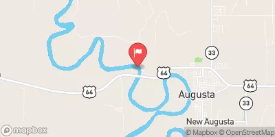 White River Near Augusta
|
16200cfs |
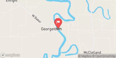 White River At Georgetown
|
16500cfs |
15-Day Long Term Forecast
Year Completed |
1975 |
Dam Length |
960 |
Dam Height |
45 |
River Or Stream |
WILLOW CREEK |
Primary Dam Type |
Earth |
Surface Area |
66 |
Hydraulic Height |
23 |
Drainage Area |
1 |
Nid Storage |
1390 |
Structural Height |
40 |
Hazard Potential |
Low |
Nid Height |
45 |
Seasonal Comparison
5-Day Hourly Forecast Detail
Dam Data Reference
Condition Assessment
SatisfactoryNo existing or potential dam safety deficiencies are recognized. Acceptable performance is expected under all loading conditions (static, hydrologic, seismic) in accordance with the minimum applicable state or federal regulatory criteria or tolerable risk guidelines.
Fair
No existing dam safety deficiencies are recognized for normal operating conditions. Rare or extreme hydrologic and/or seismic events may result in a dam safety deficiency. Risk may be in the range to take further action. Note: Rare or extreme event is defined by the regulatory agency based on their minimum
Poor A dam safety deficiency is recognized for normal operating conditions which may realistically occur. Remedial action is necessary. POOR may also be used when uncertainties exist as to critical analysis parameters which identify a potential dam safety deficiency. Investigations and studies are necessary.
Unsatisfactory
A dam safety deficiency is recognized that requires immediate or emergency remedial action for problem resolution.
Not Rated
The dam has not been inspected, is not under state or federal jurisdiction, or has been inspected but, for whatever reason, has not been rated.
Not Available
Dams for which the condition assessment is restricted to approved government users.
Hazard Potential Classification
HighDams assigned the high hazard potential classification are those where failure or mis-operation will probably cause loss of human life.
Significant
Dams assigned the significant hazard potential classification are those dams where failure or mis-operation results in no probable loss of human life but can cause economic loss, environment damage, disruption of lifeline facilities, or impact other concerns. Significant hazard potential classification dams are often located in predominantly rural or agricultural areas but could be in areas with population and significant infrastructure.
Low
Dams assigned the low hazard potential classification are those where failure or mis-operation results in no probable loss of human life and low economic and/or environmental losses. Losses are principally limited to the owner's property.
Undetermined
Dams for which a downstream hazard potential has not been designated or is not provided.
Not Available
Dams for which the downstream hazard potential is restricted to approved government users.
Area Campgrounds
| Location | Reservations | Toilets |
|---|---|---|
 Lake Poinsett State Park
|
||
 Bear Creek Lake Recreation Area
|
||
 Mississippi River SP - Beech Point
|
 Lake Dunn
 Horseshoe Lake
 Lake Greenlee
 Lake Hogue
 Spring Creek