Lemke Dam Reservoir Report
Last Updated: February 6, 2026
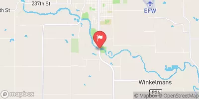
Lemke Dam, located in Adair, Iowa, along the TR-South Fork Middle River, was completed in 1970 with a primary purpose of recreation.
Summary
The dam stands at 28 feet high and spans 635 feet in length, with a storage capacity of 253 acre-feet. Owned privately and regulated by the Iowa Department of Natural Resources, Lemke Dam is classified as a low hazard potential structure with a moderate risk assessment rating.
Managed by the USDA NRCS, Lemke Dam serves as a vital water resource for the local community, offering recreational opportunities while also providing crucial flood control and water storage functions. Despite not being rated for its condition, the dam has undergone state inspection, permitting, and enforcement, ensuring its operational safety. With its uncontrolled spillway and soil foundation, Lemke Dam remains an essential infrastructure contributing to water management efforts in the region.
Climate and water resource enthusiasts can appreciate Lemke Dam for its role in safeguarding the surrounding area from potential flooding and supporting sustainable water usage practices. As a key component of the local water infrastructure, this earth dam serves as a testament to the importance of proper dam management and regulation in mitigating risks and ensuring water resource sustainability in Iowa.
°F
°F
mph
Wind
%
Humidity
15-Day Weather Outlook
Year Completed |
1970 |
Dam Length |
635 |
Dam Height |
28 |
River Or Stream |
TR-SOUTH FORK MIDDLE RIVER |
Primary Dam Type |
Earth |
Surface Area |
15 |
Drainage Area |
0.87 |
Nid Storage |
253 |
Hazard Potential |
Low |
Foundations |
Soil |
Nid Height |
28 |
Seasonal Comparison
5-Day Hourly Forecast Detail
Nearby Streamflow Levels
Dam Data Reference
Condition Assessment
SatisfactoryNo existing or potential dam safety deficiencies are recognized. Acceptable performance is expected under all loading conditions (static, hydrologic, seismic) in accordance with the minimum applicable state or federal regulatory criteria or tolerable risk guidelines.
Fair
No existing dam safety deficiencies are recognized for normal operating conditions. Rare or extreme hydrologic and/or seismic events may result in a dam safety deficiency. Risk may be in the range to take further action. Note: Rare or extreme event is defined by the regulatory agency based on their minimum
Poor A dam safety deficiency is recognized for normal operating conditions which may realistically occur. Remedial action is necessary. POOR may also be used when uncertainties exist as to critical analysis parameters which identify a potential dam safety deficiency. Investigations and studies are necessary.
Unsatisfactory
A dam safety deficiency is recognized that requires immediate or emergency remedial action for problem resolution.
Not Rated
The dam has not been inspected, is not under state or federal jurisdiction, or has been inspected but, for whatever reason, has not been rated.
Not Available
Dams for which the condition assessment is restricted to approved government users.
Hazard Potential Classification
HighDams assigned the high hazard potential classification are those where failure or mis-operation will probably cause loss of human life.
Significant
Dams assigned the significant hazard potential classification are those dams where failure or mis-operation results in no probable loss of human life but can cause economic loss, environment damage, disruption of lifeline facilities, or impact other concerns. Significant hazard potential classification dams are often located in predominantly rural or agricultural areas but could be in areas with population and significant infrastructure.
Low
Dams assigned the low hazard potential classification are those where failure or mis-operation results in no probable loss of human life and low economic and/or environmental losses. Losses are principally limited to the owner's property.
Undetermined
Dams for which a downstream hazard potential has not been designated or is not provided.
Not Available
Dams for which the downstream hazard potential is restricted to approved government users.


 Lemke Dam