Greenbriar Dam Reservoir Report
Nearby: Wolfe Dam Maffitt Reservoir Dam
Last Updated: February 6, 2026
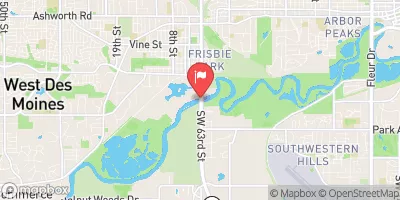
Greenbriar Dam, located in West Des Moines, Iowa, is a privately owned structure designed by A LEO PELDS ENGINEERING.
Summary
Completed in 1972, the dam serves multiple purposes, including recreation and flood control along the TR-Raccoon River. Standing at a height of 52 feet and stretching 650 feet in length, Greenbriar Dam has a storage capacity of 440 acre-feet and covers a surface area of 17.8 acres.
Despite its satisfactory condition assessment, the dam poses a significant hazard potential and has a moderate risk assessment rating. The Iowa Department of Natural Resources regulates and inspects Greenbriar Dam regularly, ensuring its compliance with state standards and safety protocols. The dam features an uncontrolled spillway type and has a drainage area of 0.55 square miles.
Water resource and climate enthusiasts will find Greenbriar Dam to be a vital structure in managing water flow and protecting the surrounding areas from potential flooding. With its strategic location and design, the dam plays a crucial role in maintaining the ecological balance while providing recreational opportunities for the local community. As a privately owned entity, Greenbriar Dam represents a collaborative effort between the owner and state regulators to uphold safety standards and ensure the dam's longevity for future generations.
°F
°F
mph
Wind
%
Humidity
15-Day Weather Outlook
Year Completed |
1972 |
Dam Length |
650 |
Dam Height |
52 |
River Or Stream |
TR-RACCOON RIVER |
Primary Dam Type |
Earth |
Surface Area |
17.8 |
Drainage Area |
0.55 |
Nid Storage |
440 |
Hazard Potential |
Significant |
Foundations |
Soil |
Nid Height |
52 |
Seasonal Comparison
5-Day Hourly Forecast Detail
Nearby Streamflow Levels
 Raccoon River Near West Des Moines
|
1300cfs |
 Raccoon River At 63rd Street At Des Moines
|
587cfs |
 Raccoon River At Van Meter
|
1640cfs |
 Walnut Creek At Des Moines
|
10cfs |
 North River Near Norwalk
|
48cfs |
 Raccoon River At Fleur Drive
|
1200cfs |
Dam Data Reference
Condition Assessment
SatisfactoryNo existing or potential dam safety deficiencies are recognized. Acceptable performance is expected under all loading conditions (static, hydrologic, seismic) in accordance with the minimum applicable state or federal regulatory criteria or tolerable risk guidelines.
Fair
No existing dam safety deficiencies are recognized for normal operating conditions. Rare or extreme hydrologic and/or seismic events may result in a dam safety deficiency. Risk may be in the range to take further action. Note: Rare or extreme event is defined by the regulatory agency based on their minimum
Poor A dam safety deficiency is recognized for normal operating conditions which may realistically occur. Remedial action is necessary. POOR may also be used when uncertainties exist as to critical analysis parameters which identify a potential dam safety deficiency. Investigations and studies are necessary.
Unsatisfactory
A dam safety deficiency is recognized that requires immediate or emergency remedial action for problem resolution.
Not Rated
The dam has not been inspected, is not under state or federal jurisdiction, or has been inspected but, for whatever reason, has not been rated.
Not Available
Dams for which the condition assessment is restricted to approved government users.
Hazard Potential Classification
HighDams assigned the high hazard potential classification are those where failure or mis-operation will probably cause loss of human life.
Significant
Dams assigned the significant hazard potential classification are those dams where failure or mis-operation results in no probable loss of human life but can cause economic loss, environment damage, disruption of lifeline facilities, or impact other concerns. Significant hazard potential classification dams are often located in predominantly rural or agricultural areas but could be in areas with population and significant infrastructure.
Low
Dams assigned the low hazard potential classification are those where failure or mis-operation results in no probable loss of human life and low economic and/or environmental losses. Losses are principally limited to the owner's property.
Undetermined
Dams for which a downstream hazard potential has not been designated or is not provided.
Not Available
Dams for which the downstream hazard potential is restricted to approved government users.

 Greenbriar Dam
 360th Street Dallas County