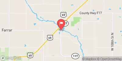
Sage Dam Reservoir Report
Nearby: Gannon Dam Hanke Dam
Last Updated: February 5, 2026
Sage Dam, located in Jasper County, Iowa, is a private earth dam completed in 1970 for fire protection, stock, and small fish pond purposes.
°F
°F
mph
Wind
%
Humidity
15-Day Weather Outlook
Summary
The dam stands at a height of 28 feet and spans 335 feet in length, with a storage capacity of 178 acre-feet. Situated on TR-Sugar Creek, the dam is regulated by the Iowa Department of Natural Resources and undergoes regular inspections and enforcement to ensure its structural integrity and safety.
With a low hazard potential and a moderate risk assessment rating, Sage Dam presents a manageable risk level for the local community. Although the dam's condition is currently not rated, its emergency action plan status and risk management measures are under evaluation. The dam's primary designer is the USDA NRCS, working in conjunction with state agencies to oversee its operations and maintenance.
As a vital component of the local water resource infrastructure, Sage Dam serves as a critical asset for water supply, wildlife habitat, and flood control in the region. Its strategic location in Colfax, Iowa, highlights its importance in providing essential services to surrounding areas while maintaining a balance between water resource management and environmental conservation efforts.
Year Completed |
1970 |
Dam Length |
335 |
Dam Height |
28 |
River Or Stream |
TR-SUGAR CREEK |
Primary Dam Type |
Earth |
Surface Area |
9 |
Drainage Area |
0.91 |
Nid Storage |
178 |
Hazard Potential |
Low |
Foundations |
Soil |
Nid Height |
28 |
Seasonal Comparison
Hourly Weather Forecast
Nearby Streamflow Levels
Dam Data Reference
Condition Assessment
SatisfactoryNo existing or potential dam safety deficiencies are recognized. Acceptable performance is expected under all loading conditions (static, hydrologic, seismic) in accordance with the minimum applicable state or federal regulatory criteria or tolerable risk guidelines.
Fair
No existing dam safety deficiencies are recognized for normal operating conditions. Rare or extreme hydrologic and/or seismic events may result in a dam safety deficiency. Risk may be in the range to take further action. Note: Rare or extreme event is defined by the regulatory agency based on their minimum
Poor A dam safety deficiency is recognized for normal operating conditions which may realistically occur. Remedial action is necessary. POOR may also be used when uncertainties exist as to critical analysis parameters which identify a potential dam safety deficiency. Investigations and studies are necessary.
Unsatisfactory
A dam safety deficiency is recognized that requires immediate or emergency remedial action for problem resolution.
Not Rated
The dam has not been inspected, is not under state or federal jurisdiction, or has been inspected but, for whatever reason, has not been rated.
Not Available
Dams for which the condition assessment is restricted to approved government users.
Hazard Potential Classification
HighDams assigned the high hazard potential classification are those where failure or mis-operation will probably cause loss of human life.
Significant
Dams assigned the significant hazard potential classification are those dams where failure or mis-operation results in no probable loss of human life but can cause economic loss, environment damage, disruption of lifeline facilities, or impact other concerns. Significant hazard potential classification dams are often located in predominantly rural or agricultural areas but could be in areas with population and significant infrastructure.
Low
Dams assigned the low hazard potential classification are those where failure or mis-operation results in no probable loss of human life and low economic and/or environmental losses. Losses are principally limited to the owner's property.
Undetermined
Dams for which a downstream hazard potential has not been designated or is not provided.
Not Available
Dams for which the downstream hazard potential is restricted to approved government users.


 Sage Dam