Wells Dam Reservoir Report
Nearby: Morr Dam Greenbelt Wetland Dam
Last Updated: February 4, 2026
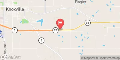
Wells Dam is a private-owned structure located in Lucas County, Iowa, specifically within the Rathbun Reservoir area along the TR-Chariton River.
°F
°F
mph
Wind
%
Humidity
15-Day Weather Outlook
Summary
Built in 1960 by the USDA NRCS, this earth-type dam stands at a height of 25 feet with a length of 560 feet, providing fire protection and serving as a stock or small fish pond. With a storage capacity of 100 acre-feet and a surface area of 7.8 acres, Wells Dam plays a crucial role in managing water resources in the region.
Despite its low hazard potential and moderate risk assessment rating, Wells Dam is regularly inspected by the Iowa Department of Natural Resources to ensure its structural integrity and compliance with state regulations. The dam's primary purpose and design reflect its importance in safeguarding the surrounding area from potential flooding and supporting local wildlife. With its location in a scenic part of Iowa, Wells Dam serves as a vital component of the water infrastructure, highlighting the intersection of water resource management and climate resilience in the region.
As an essential feature in the Rock Island District, Wells Dam stands as a testament to the collaborative efforts between private ownership and government agencies to maintain water quality and protect the environment. Its historical significance and functional purpose underscore the need for sustainable water management practices in the face of changing climate conditions. For water resource and climate enthusiasts, Wells Dam represents a tangible example of the intersection between infrastructure development, environmental stewardship, and community resilience in the ongoing effort to ensure a sustainable future for generations to come.
Year Completed |
1960 |
Dam Length |
560 |
Dam Height |
25 |
River Or Stream |
TR-CHARITON RIVER |
Primary Dam Type |
Earth |
Surface Area |
7.8 |
Drainage Area |
0.12 |
Nid Storage |
100 |
Hazard Potential |
Low |
Foundations |
Soil |
Nid Height |
25 |
Seasonal Comparison
Hourly Weather Forecast
Nearby Streamflow Levels
Dam Data Reference
Condition Assessment
SatisfactoryNo existing or potential dam safety deficiencies are recognized. Acceptable performance is expected under all loading conditions (static, hydrologic, seismic) in accordance with the minimum applicable state or federal regulatory criteria or tolerable risk guidelines.
Fair
No existing dam safety deficiencies are recognized for normal operating conditions. Rare or extreme hydrologic and/or seismic events may result in a dam safety deficiency. Risk may be in the range to take further action. Note: Rare or extreme event is defined by the regulatory agency based on their minimum
Poor A dam safety deficiency is recognized for normal operating conditions which may realistically occur. Remedial action is necessary. POOR may also be used when uncertainties exist as to critical analysis parameters which identify a potential dam safety deficiency. Investigations and studies are necessary.
Unsatisfactory
A dam safety deficiency is recognized that requires immediate or emergency remedial action for problem resolution.
Not Rated
The dam has not been inspected, is not under state or federal jurisdiction, or has been inspected but, for whatever reason, has not been rated.
Not Available
Dams for which the condition assessment is restricted to approved government users.
Hazard Potential Classification
HighDams assigned the high hazard potential classification are those where failure or mis-operation will probably cause loss of human life.
Significant
Dams assigned the significant hazard potential classification are those dams where failure or mis-operation results in no probable loss of human life but can cause economic loss, environment damage, disruption of lifeline facilities, or impact other concerns. Significant hazard potential classification dams are often located in predominantly rural or agricultural areas but could be in areas with population and significant infrastructure.
Low
Dams assigned the low hazard potential classification are those where failure or mis-operation results in no probable loss of human life and low economic and/or environmental losses. Losses are principally limited to the owner's property.
Undetermined
Dams for which a downstream hazard potential has not been designated or is not provided.
Not Available
Dams for which the downstream hazard potential is restricted to approved government users.
Area Campgrounds
| Location | Reservations | Toilets |
|---|---|---|
 Red Haw State Park Campground
|
||
 Black Oak Camp
|
||
 Longbeard Camp
|
||
 White Oak Camp
|


 Wells Dam