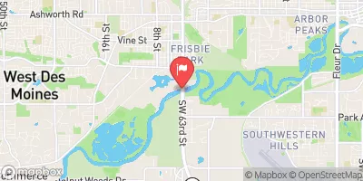
Badger Creek Watershed Site 38-1 Reservoir Report
Last Updated: February 5, 2026
Badger Creek Watershed Site 38-1, located in Carlisle, Iowa, is a crucial water resource managed by the local government and designed by USDA NRCS.
°F
°F
mph
Wind
%
Humidity
15-Day Weather Outlook
Summary
This site serves multiple purposes including fire protection, stock, small fish pond, and flood risk reduction. The primary dam type at this site is earth, with a height of 28 feet and a length of 613 feet, completed in 1963. The dam has a storage capacity of 177 acre-feet and covers a surface area of 11.2 acres, with a drainage area of 0.93 square miles.
The dam at Badger Creek Watershed Site 38-1 is regulated by the Iowa DNR, with state permitting, inspection, and enforcement in place. Despite being classified as having a low hazard potential, the risk assessment indicates a moderate risk level. The site does not have an emergency action plan (EAP) prepared, and the condition assessment is marked as 'Not Rated'. Overall, this site presents an opportunity for water resource and climate enthusiasts to study the management and impact of a vital water structure in the region, with potential for further research and monitoring to ensure its continued effectiveness and safety.
Year Completed |
1963 |
Dam Length |
613 |
Dam Height |
28 |
River Or Stream |
TR-BADGER CREEK |
Primary Dam Type |
Earth |
Surface Area |
11.2 |
Drainage Area |
0.93 |
Nid Storage |
177 |
Hazard Potential |
Low |
Foundations |
Soil |
Nid Height |
28 |
Seasonal Comparison
Hourly Weather Forecast
Nearby Streamflow Levels
 Raccoon River At Van Meter
|
1640cfs |
 Raccoon River Near West Des Moines
|
1300cfs |
 Raccoon River At 63rd Street At Des Moines
|
587cfs |
 North River Near Norwalk
|
48cfs |
 Walnut Creek At Des Moines
|
10cfs |
 South Raccoon River At Redfield
|
268cfs |
Dam Data Reference
Condition Assessment
SatisfactoryNo existing or potential dam safety deficiencies are recognized. Acceptable performance is expected under all loading conditions (static, hydrologic, seismic) in accordance with the minimum applicable state or federal regulatory criteria or tolerable risk guidelines.
Fair
No existing dam safety deficiencies are recognized for normal operating conditions. Rare or extreme hydrologic and/or seismic events may result in a dam safety deficiency. Risk may be in the range to take further action. Note: Rare or extreme event is defined by the regulatory agency based on their minimum
Poor A dam safety deficiency is recognized for normal operating conditions which may realistically occur. Remedial action is necessary. POOR may also be used when uncertainties exist as to critical analysis parameters which identify a potential dam safety deficiency. Investigations and studies are necessary.
Unsatisfactory
A dam safety deficiency is recognized that requires immediate or emergency remedial action for problem resolution.
Not Rated
The dam has not been inspected, is not under state or federal jurisdiction, or has been inspected but, for whatever reason, has not been rated.
Not Available
Dams for which the condition assessment is restricted to approved government users.
Hazard Potential Classification
HighDams assigned the high hazard potential classification are those where failure or mis-operation will probably cause loss of human life.
Significant
Dams assigned the significant hazard potential classification are those dams where failure or mis-operation results in no probable loss of human life but can cause economic loss, environment damage, disruption of lifeline facilities, or impact other concerns. Significant hazard potential classification dams are often located in predominantly rural or agricultural areas but could be in areas with population and significant infrastructure.
Low
Dams assigned the low hazard potential classification are those where failure or mis-operation results in no probable loss of human life and low economic and/or environmental losses. Losses are principally limited to the owner's property.
Undetermined
Dams for which a downstream hazard potential has not been designated or is not provided.
Not Available
Dams for which the downstream hazard potential is restricted to approved government users.

 Badger Creek Watershed Site 38-1
 120th Street Madison County