Perkins Dam Reservoir Report
Nearby: Robinson Dam Akerman Dam
Last Updated: February 2, 2026
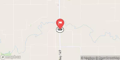
Perkins Dam, located in Mahaska County, Iowa, is a privately owned structure primarily used for fire protection, stock, and small fish pond purposes.
°F
°F
mph
Wind
%
Humidity
15-Day Weather Outlook
Summary
Constructed in 1970 by the USDA NRCS, this earth dam stands at 29 feet in height and spans 459 feet in length. With a storage capacity of 90 acre-feet, this dam sits on the TR-South Skunk River and covers a surface area of 3.9 acres, serving a drainage area of 0.97 square miles.
The dam's spillway, classified as uncontrolled, has a width of 0 feet, indicating minimal discharge capabilities. Despite its low hazard potential and moderate risk assessment rating, Perkins Dam has not been rated for its overall condition. The Iowa DNR oversees the regulation, inspection, and enforcement of this structure, ensuring its compliance with state permitting requirements. While no emergency action plan is currently in place, the dam remains a crucial asset for water resource management and environmental conservation in the region.
With its strategic location and functionality, Perkins Dam contributes to maintaining water levels, protecting against fires, and supporting wildlife in the surrounding area. As an essential component of the local ecosystem, this dam serves as a testament to sustainable water resource management practices and the ongoing efforts to safeguard our natural environment against potential risks and hazards.
Year Completed |
1970 |
Dam Length |
459 |
Dam Height |
29 |
River Or Stream |
TR-SOUTH SKUNK RIVER |
Primary Dam Type |
Earth |
Surface Area |
3.9 |
Drainage Area |
0.97 |
Nid Storage |
90 |
Hazard Potential |
Low |
Foundations |
Soil |
Nid Height |
29 |
Seasonal Comparison
Hourly Weather Forecast
Nearby Streamflow Levels
 North Skunk River Near Sigourney
|
97cfs |
 South Skunk River Near Oskaloosa
|
485cfs |
 Des Moines River At Ottumwa
|
1090cfs |
 Des Moines River Near Tracy
|
1400cfs |
 Cedar Creek Near Bussey
|
11cfs |
 Des Moines River Near Pella
|
2950cfs |
Dam Data Reference
Condition Assessment
SatisfactoryNo existing or potential dam safety deficiencies are recognized. Acceptable performance is expected under all loading conditions (static, hydrologic, seismic) in accordance with the minimum applicable state or federal regulatory criteria or tolerable risk guidelines.
Fair
No existing dam safety deficiencies are recognized for normal operating conditions. Rare or extreme hydrologic and/or seismic events may result in a dam safety deficiency. Risk may be in the range to take further action. Note: Rare or extreme event is defined by the regulatory agency based on their minimum
Poor A dam safety deficiency is recognized for normal operating conditions which may realistically occur. Remedial action is necessary. POOR may also be used when uncertainties exist as to critical analysis parameters which identify a potential dam safety deficiency. Investigations and studies are necessary.
Unsatisfactory
A dam safety deficiency is recognized that requires immediate or emergency remedial action for problem resolution.
Not Rated
The dam has not been inspected, is not under state or federal jurisdiction, or has been inspected but, for whatever reason, has not been rated.
Not Available
Dams for which the condition assessment is restricted to approved government users.
Hazard Potential Classification
HighDams assigned the high hazard potential classification are those where failure or mis-operation will probably cause loss of human life.
Significant
Dams assigned the significant hazard potential classification are those dams where failure or mis-operation results in no probable loss of human life but can cause economic loss, environment damage, disruption of lifeline facilities, or impact other concerns. Significant hazard potential classification dams are often located in predominantly rural or agricultural areas but could be in areas with population and significant infrastructure.
Low
Dams assigned the low hazard potential classification are those where failure or mis-operation results in no probable loss of human life and low economic and/or environmental losses. Losses are principally limited to the owner's property.
Undetermined
Dams for which a downstream hazard potential has not been designated or is not provided.
Not Available
Dams for which the downstream hazard potential is restricted to approved government users.
Area Campgrounds
| Location | Reservations | Toilets |
|---|---|---|
 Lake Keomah State Park Campground
|
||
 Lake Keomah State Park
|
||
 Glendale Access
|

 Perkins Dam