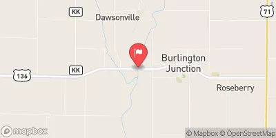
Miller Dam Reservoir Report
Last Updated: February 8, 2026
Miller Dam, located in Page, Iowa, along the Middle Tarkio River, was completed in 1966 by the USDA NRCS.
Summary
This private dam serves multiple purposes, including fire protection and creating a small fish pond, with a primary purpose of providing water for stock. With a height of 29 feet and a length of 482 feet, the dam has a storage capacity of 63 acre-feet and covers a surface area of 4.5 acres. Despite its low hazard potential and moderate risk assessment, the dam is regulated and inspected by the Iowa Department of Natural Resources to ensure its safety and compliance with state regulations.
Owned privately, Miller Dam is classified as an earth dam with a soil foundation. It does not have a controlled spillway and has not been modified in recent years. While its condition is currently not rated, the dam is regularly monitored to prevent any potential risks. In case of emergencies, the dam does not have an Emergency Action Plan (EAP) in place, and its hazard potential is considered low. However, with its crucial role in supporting local water resources and the ecosystem, ongoing risk management measures are essential to ensure the safety and longevity of Miller Dam for the community and the environment.
°F
°F
mph
Wind
%
Humidity
15-Day Weather Outlook
Year Completed |
1966 |
Dam Length |
482 |
Dam Height |
29 |
River Or Stream |
TR-MIDDLE TARKIO RIVER |
Primary Dam Type |
Earth |
Surface Area |
4.5 |
Drainage Area |
0.56 |
Nid Storage |
63 |
Hazard Potential |
Low |
Foundations |
Soil |
Nid Height |
29 |
Seasonal Comparison
5-Day Hourly Forecast Detail
Nearby Streamflow Levels
Dam Data Reference
Condition Assessment
SatisfactoryNo existing or potential dam safety deficiencies are recognized. Acceptable performance is expected under all loading conditions (static, hydrologic, seismic) in accordance with the minimum applicable state or federal regulatory criteria or tolerable risk guidelines.
Fair
No existing dam safety deficiencies are recognized for normal operating conditions. Rare or extreme hydrologic and/or seismic events may result in a dam safety deficiency. Risk may be in the range to take further action. Note: Rare or extreme event is defined by the regulatory agency based on their minimum
Poor A dam safety deficiency is recognized for normal operating conditions which may realistically occur. Remedial action is necessary. POOR may also be used when uncertainties exist as to critical analysis parameters which identify a potential dam safety deficiency. Investigations and studies are necessary.
Unsatisfactory
A dam safety deficiency is recognized that requires immediate or emergency remedial action for problem resolution.
Not Rated
The dam has not been inspected, is not under state or federal jurisdiction, or has been inspected but, for whatever reason, has not been rated.
Not Available
Dams for which the condition assessment is restricted to approved government users.
Hazard Potential Classification
HighDams assigned the high hazard potential classification are those where failure or mis-operation will probably cause loss of human life.
Significant
Dams assigned the significant hazard potential classification are those dams where failure or mis-operation results in no probable loss of human life but can cause economic loss, environment damage, disruption of lifeline facilities, or impact other concerns. Significant hazard potential classification dams are often located in predominantly rural or agricultural areas but could be in areas with population and significant infrastructure.
Low
Dams assigned the low hazard potential classification are those where failure or mis-operation results in no probable loss of human life and low economic and/or environmental losses. Losses are principally limited to the owner's property.
Undetermined
Dams for which a downstream hazard potential has not been designated or is not provided.
Not Available
Dams for which the downstream hazard potential is restricted to approved government users.
Area Campgrounds
| Location | Reservations | Toilets |
|---|---|---|
 Pioneer County Park Campgrounds
|
||
 Pioneer City Park
|
||
 Pierce Creek Rec Area
|


 Miller Dam