Gant Creek Watershed Site A-4 Reservoir Report
Last Updated: January 10, 2026
Located in Plymouth County, Iowa, Gant Creek Watershed Site A-4 is a vital water resource managed by the local government and designed by the USDA NRCS.
°F
°F
mph
Wind
%
Humidity
Summary
This site serves multiple purposes including fire protection, stock, small fish pond, and flood risk reduction. Completed in 1969, the earth dam stands at a height of 34 feet and has a storage capacity of 54 acre-feet, with a surface area of 3.6 acres and a drainage area of 1.43 square miles.
The dam, situated on the TR-Big Sioux River, is regulated by the Iowa Department of Natural Resources and has a low hazard potential with a moderate risk assessment rating. While the condition of the dam is currently not rated, it undergoes regular inspections, permitting, and enforcement by state authorities. With its strategic location and purpose, Gant Creek Watershed Site A-4 plays a crucial role in water management, conservation, and protection in the region.
Water resource and climate enthusiasts will find Gant Creek Watershed Site A-4 intriguing for its engineering design, environmental impact, and management protocols. As part of the larger water infrastructure in Iowa, this site exemplifies the importance of sustainable water resource management and the collaboration between local governments, federal agencies, and state regulators. By understanding the intricacies of this watershed site, enthusiasts can gain insights into the complexities of balancing water use for various purposes while ensuring the safety and sustainability of the ecosystem.
Year Completed |
1969 |
Dam Length |
389 |
Dam Height |
34 |
River Or Stream |
TR-BIG SIOUX RIVER |
Primary Dam Type |
Earth |
Surface Area |
3.6 |
Drainage Area |
1.43 |
Nid Storage |
54 |
Hazard Potential |
Low |
Foundations |
Soil |
Nid Height |
34 |
Seasonal Comparison
Weather Forecast
Nearby Streamflow Levels
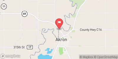
 Big Sioux River At Akron
|
816cfs |
 Perry Creek Near Milnerville
|
25cfs |
 Floyd River At James
|
187cfs |
 Missouri River At Sioux City
|
13200cfs |
 Vermillion River Nr Vermillion Sd
|
33cfs |
 Omaha Cr At Homer
|
45cfs |
Dam Data Reference
Condition Assessment
SatisfactoryNo existing or potential dam safety deficiencies are recognized. Acceptable performance is expected under all loading conditions (static, hydrologic, seismic) in accordance with the minimum applicable state or federal regulatory criteria or tolerable risk guidelines.
Fair
No existing dam safety deficiencies are recognized for normal operating conditions. Rare or extreme hydrologic and/or seismic events may result in a dam safety deficiency. Risk may be in the range to take further action. Note: Rare or extreme event is defined by the regulatory agency based on their minimum
Poor A dam safety deficiency is recognized for normal operating conditions which may realistically occur. Remedial action is necessary. POOR may also be used when uncertainties exist as to critical analysis parameters which identify a potential dam safety deficiency. Investigations and studies are necessary.
Unsatisfactory
A dam safety deficiency is recognized that requires immediate or emergency remedial action for problem resolution.
Not Rated
The dam has not been inspected, is not under state or federal jurisdiction, or has been inspected but, for whatever reason, has not been rated.
Not Available
Dams for which the condition assessment is restricted to approved government users.
Hazard Potential Classification
HighDams assigned the high hazard potential classification are those where failure or mis-operation will probably cause loss of human life.
Significant
Dams assigned the significant hazard potential classification are those dams where failure or mis-operation results in no probable loss of human life but can cause economic loss, environment damage, disruption of lifeline facilities, or impact other concerns. Significant hazard potential classification dams are often located in predominantly rural or agricultural areas but could be in areas with population and significant infrastructure.
Low
Dams assigned the low hazard potential classification are those where failure or mis-operation results in no probable loss of human life and low economic and/or environmental losses. Losses are principally limited to the owner's property.
Undetermined
Dams for which a downstream hazard potential has not been designated or is not provided.
Not Available
Dams for which the downstream hazard potential is restricted to approved government users.

 Gant Creek Watershed Site A-4
 220th Street Plymouth County