Gant Creek Watershed Site D-3 Reservoir Report
Last Updated: January 10, 2026
Located in Sioux City, Iowa, the Gant Creek Watershed Site D-3 is a vital water resource managed by the local government with oversight from the Iowa Department of Natural Resources.
°F
°F
mph
Wind
%
Humidity
Summary
Designed by the USDA NRCS, this earth dam serves multiple purposes including fire protection, stock, small fish pond, and flood risk reduction. Completed in 1967, the dam stands at a height of 36 feet with a length of 447 feet, providing a storage capacity of 64 acre-feet and covering a surface area of 5.2 acres.
The Gant Creek Watershed Site D-3 is regulated and inspected by the Iowa DNR, with a low hazard potential and a moderate risk assessment rating. While the condition assessment is currently not rated, the dam meets state permitting and inspection requirements. The dam's primary purpose of fire protection and flood risk reduction highlights its importance in ensuring water security for the local community, especially along the TR-Big Sioux River. With a commitment to effective risk management measures, the site plays a crucial role in maintaining water quality and quantity in the region.
As a key component of the local water infrastructure, the Gant Creek Watershed Site D-3 represents a significant investment in water management and conservation efforts. Its strategic location, design, and operational features demonstrate a proactive approach to addressing water resource challenges in the area. With continued collaboration between local government, regulatory agencies, and stakeholders, the site contributes to sustainable water resource management practices and climate resilience in the region.
Year Completed |
1967 |
Dam Length |
447 |
Dam Height |
36 |
River Or Stream |
TR-BIG SIOUX RIVER |
Primary Dam Type |
Earth |
Surface Area |
5.2 |
Drainage Area |
0.51 |
Nid Storage |
64 |
Hazard Potential |
Low |
Foundations |
Soil |
Nid Height |
36 |
Seasonal Comparison
Weather Forecast
Nearby Streamflow Levels
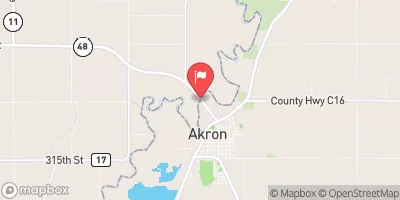
 Big Sioux River At Akron
|
816cfs |
 Perry Creek Near Milnerville
|
25cfs |
 Vermillion River Nr Vermillion Sd
|
33cfs |
 Floyd River At James
|
187cfs |
 Missouri River At Sioux City
|
13200cfs |
 Omaha Cr At Homer
|
45cfs |
Dam Data Reference
Condition Assessment
SatisfactoryNo existing or potential dam safety deficiencies are recognized. Acceptable performance is expected under all loading conditions (static, hydrologic, seismic) in accordance with the minimum applicable state or federal regulatory criteria or tolerable risk guidelines.
Fair
No existing dam safety deficiencies are recognized for normal operating conditions. Rare or extreme hydrologic and/or seismic events may result in a dam safety deficiency. Risk may be in the range to take further action. Note: Rare or extreme event is defined by the regulatory agency based on their minimum
Poor A dam safety deficiency is recognized for normal operating conditions which may realistically occur. Remedial action is necessary. POOR may also be used when uncertainties exist as to critical analysis parameters which identify a potential dam safety deficiency. Investigations and studies are necessary.
Unsatisfactory
A dam safety deficiency is recognized that requires immediate or emergency remedial action for problem resolution.
Not Rated
The dam has not been inspected, is not under state or federal jurisdiction, or has been inspected but, for whatever reason, has not been rated.
Not Available
Dams for which the condition assessment is restricted to approved government users.
Hazard Potential Classification
HighDams assigned the high hazard potential classification are those where failure or mis-operation will probably cause loss of human life.
Significant
Dams assigned the significant hazard potential classification are those dams where failure or mis-operation results in no probable loss of human life but can cause economic loss, environment damage, disruption of lifeline facilities, or impact other concerns. Significant hazard potential classification dams are often located in predominantly rural or agricultural areas but could be in areas with population and significant infrastructure.
Low
Dams assigned the low hazard potential classification are those where failure or mis-operation results in no probable loss of human life and low economic and/or environmental losses. Losses are principally limited to the owner's property.
Undetermined
Dams for which a downstream hazard potential has not been designated or is not provided.
Not Available
Dams for which the downstream hazard potential is restricted to approved government users.

 Gant Creek Watershed Site D-3
 State Highway 3 Plymouth County