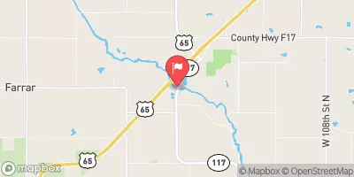
Ross Dam Reservoir Report
Nearby: Clements Dam Bennett Dam
Last Updated: February 5, 2026
Ross Dam, located in Colfax, Iowa, is a privately owned structure designed by the USDA NRCS and regulated by the Iowa DNR.
°F
°F
mph
Wind
%
Humidity
15-Day Weather Outlook
Summary
Completed in 1968, this earth dam stands at a height of 26 feet and spans 272 feet in length, with a storage capacity of 58 acre-feet for purposes such as fire protection and small fish pond management. Situated on the TR-Skunk River, Ross Dam is classified as having a low hazard potential and a moderate risk assessment.
With a surface area of 4.2 acres and a drainage area of 0.29 square miles, Ross Dam plays a crucial role in water resource management in the region. Despite its small size, the dam serves as a vital asset for fire protection and stock maintenance. The dam's uncontrolled spillway and soil foundation contribute to its overall structure, while its location within the Rock Island District ensures compliance with state regulations and inspections.
Water resource and climate enthusiasts can appreciate Ross Dam as a key component of the local ecosystem, providing both practical benefits for the community and a unique habitat for various species. As a privately owned entity with a history of responsible management, Ross Dam serves as a testament to the importance of sustainable water infrastructure in maintaining a balanced environment for all.
Year Completed |
1968 |
Dam Length |
272 |
Dam Height |
26 |
River Or Stream |
TR-SKUNK RIVER |
Primary Dam Type |
Earth |
Surface Area |
4.2 |
Drainage Area |
0.29 |
Nid Storage |
58 |
Hazard Potential |
Low |
Foundations |
Soil |
Nid Height |
26 |
Seasonal Comparison
Hourly Weather Forecast
Nearby Streamflow Levels
 Indian Creek Near Mingo
|
79cfs |
 South Skunk River At Colfax
|
211cfs |
 Fourmile Creek Near Ankeny
|
9cfs |
 Fourmile Creek At Des Moines
|
22cfs |
 Des Moines River At 2nd Avenue
|
418cfs |
 Des Moines River Near Saylorville
|
1890cfs |
Dam Data Reference
Condition Assessment
SatisfactoryNo existing or potential dam safety deficiencies are recognized. Acceptable performance is expected under all loading conditions (static, hydrologic, seismic) in accordance with the minimum applicable state or federal regulatory criteria or tolerable risk guidelines.
Fair
No existing dam safety deficiencies are recognized for normal operating conditions. Rare or extreme hydrologic and/or seismic events may result in a dam safety deficiency. Risk may be in the range to take further action. Note: Rare or extreme event is defined by the regulatory agency based on their minimum
Poor A dam safety deficiency is recognized for normal operating conditions which may realistically occur. Remedial action is necessary. POOR may also be used when uncertainties exist as to critical analysis parameters which identify a potential dam safety deficiency. Investigations and studies are necessary.
Unsatisfactory
A dam safety deficiency is recognized that requires immediate or emergency remedial action for problem resolution.
Not Rated
The dam has not been inspected, is not under state or federal jurisdiction, or has been inspected but, for whatever reason, has not been rated.
Not Available
Dams for which the condition assessment is restricted to approved government users.
Hazard Potential Classification
HighDams assigned the high hazard potential classification are those where failure or mis-operation will probably cause loss of human life.
Significant
Dams assigned the significant hazard potential classification are those dams where failure or mis-operation results in no probable loss of human life but can cause economic loss, environment damage, disruption of lifeline facilities, or impact other concerns. Significant hazard potential classification dams are often located in predominantly rural or agricultural areas but could be in areas with population and significant infrastructure.
Low
Dams assigned the low hazard potential classification are those where failure or mis-operation results in no probable loss of human life and low economic and/or environmental losses. Losses are principally limited to the owner's property.
Undetermined
Dams for which a downstream hazard potential has not been designated or is not provided.
Not Available
Dams for which the downstream hazard potential is restricted to approved government users.

 Ross Dam