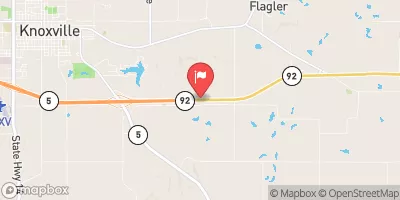
Honey Creek Watershed Site D-6 Reservoir Report
Last Updated: February 4, 2026
Located in Lucas County, Iowa, Honey Creek Watershed Site D-6 is a local government-owned dam designed by USDA NRCS and regulated by the Iowa DNR.
°F
°F
mph
Wind
%
Humidity
15-Day Weather Outlook
Summary
Completed in 1955, this earth dam serves multiple purposes including fire protection, stock, small fish pond, and flood risk reduction. With a height of 24 feet and a length of 300 feet, the dam has a storage capacity of 83 acre-feet and covers a surface area of 5.5 acres.
With a drainage area of 0.22 square miles, Honey Creek Watershed Site D-6 is classified as having a low hazard potential and a moderate risk level. Despite not having a condition rating, the dam is regularly inspected, permitted, and enforced by the state regulatory agency. The dam's spillway type is uncontrolled, and it is located near the Rathbun Reservoir, providing essential water resource management and support for the local ecosystem in the area.
Overall, Honey Creek Watershed Site D-6 is a vital infrastructure for water resource and climate enthusiasts to monitor and study in the Lucas County region of Iowa. Its construction and maintenance reflect a commitment to both environmental protection and the safety of the surrounding community, making it a significant asset in the local watershed management system.
Year Completed |
1955 |
Dam Length |
300 |
Dam Height |
24 |
River Or Stream |
TR-HONEY CREEK |
Primary Dam Type |
Earth |
Surface Area |
5.5 |
Drainage Area |
0.22 |
Nid Storage |
83 |
Hazard Potential |
Low |
Foundations |
Soil |
Nid Height |
24 |
Seasonal Comparison
Hourly Weather Forecast
Nearby Streamflow Levels
Dam Data Reference
Condition Assessment
SatisfactoryNo existing or potential dam safety deficiencies are recognized. Acceptable performance is expected under all loading conditions (static, hydrologic, seismic) in accordance with the minimum applicable state or federal regulatory criteria or tolerable risk guidelines.
Fair
No existing dam safety deficiencies are recognized for normal operating conditions. Rare or extreme hydrologic and/or seismic events may result in a dam safety deficiency. Risk may be in the range to take further action. Note: Rare or extreme event is defined by the regulatory agency based on their minimum
Poor A dam safety deficiency is recognized for normal operating conditions which may realistically occur. Remedial action is necessary. POOR may also be used when uncertainties exist as to critical analysis parameters which identify a potential dam safety deficiency. Investigations and studies are necessary.
Unsatisfactory
A dam safety deficiency is recognized that requires immediate or emergency remedial action for problem resolution.
Not Rated
The dam has not been inspected, is not under state or federal jurisdiction, or has been inspected but, for whatever reason, has not been rated.
Not Available
Dams for which the condition assessment is restricted to approved government users.
Hazard Potential Classification
HighDams assigned the high hazard potential classification are those where failure or mis-operation will probably cause loss of human life.
Significant
Dams assigned the significant hazard potential classification are those dams where failure or mis-operation results in no probable loss of human life but can cause economic loss, environment damage, disruption of lifeline facilities, or impact other concerns. Significant hazard potential classification dams are often located in predominantly rural or agricultural areas but could be in areas with population and significant infrastructure.
Low
Dams assigned the low hazard potential classification are those where failure or mis-operation results in no probable loss of human life and low economic and/or environmental losses. Losses are principally limited to the owner's property.
Undetermined
Dams for which a downstream hazard potential has not been designated or is not provided.
Not Available
Dams for which the downstream hazard potential is restricted to approved government users.


 Honey Creek Watershed Site D-6