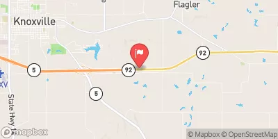
Beech Lake Dam Reservoir Report
Nearby: Corrigan Dam Hill Dam
Last Updated: February 4, 2026
Beech Lake Dam, located in Warren County, Iowa, was completed in 1961 and serves primarily as a recreational structure.
°F
°F
mph
Wind
%
Humidity
15-Day Weather Outlook
Summary
The dam, with a height of 25 feet and a length of 700 feet, holds a storage capacity of 514 acre-feet and covers a surface area of 43 acres. Situated on TR-COAL CREEK near the RED ROCK RESERVOIR, the dam is owned privately but regulated by the Iowa Department of Natural Resources (DNR) and subject to state inspection and enforcement.
Despite being classified as having a low hazard potential, Beech Lake Dam is considered to have a moderate risk level, with a risk assessment rating of 3. The dam is primarily constructed of earth and sits on a soil foundation. Although the dam does not feature a controlled spillway, it is equipped with emergency action plans (EAP) to ensure proper response in case of an emergency. The dam is not under the jurisdiction of the US Army Corps of Engineers and has not been rated for its condition, but continues to be regularly inspected by state authorities to ensure its safety and functionality for water resource and climate enthusiasts to enjoy.
Year Completed |
1961 |
Dam Length |
700 |
Dam Height |
25 |
River Or Stream |
TR-COAL CREEK |
Primary Dam Type |
Earth |
Surface Area |
43 |
Drainage Area |
2.07 |
Nid Storage |
514 |
Hazard Potential |
Low |
Foundations |
Soil |
Nid Height |
25 |
Seasonal Comparison
Hourly Weather Forecast
Nearby Streamflow Levels
Dam Data Reference
Condition Assessment
SatisfactoryNo existing or potential dam safety deficiencies are recognized. Acceptable performance is expected under all loading conditions (static, hydrologic, seismic) in accordance with the minimum applicable state or federal regulatory criteria or tolerable risk guidelines.
Fair
No existing dam safety deficiencies are recognized for normal operating conditions. Rare or extreme hydrologic and/or seismic events may result in a dam safety deficiency. Risk may be in the range to take further action. Note: Rare or extreme event is defined by the regulatory agency based on their minimum
Poor A dam safety deficiency is recognized for normal operating conditions which may realistically occur. Remedial action is necessary. POOR may also be used when uncertainties exist as to critical analysis parameters which identify a potential dam safety deficiency. Investigations and studies are necessary.
Unsatisfactory
A dam safety deficiency is recognized that requires immediate or emergency remedial action for problem resolution.
Not Rated
The dam has not been inspected, is not under state or federal jurisdiction, or has been inspected but, for whatever reason, has not been rated.
Not Available
Dams for which the condition assessment is restricted to approved government users.
Hazard Potential Classification
HighDams assigned the high hazard potential classification are those where failure or mis-operation will probably cause loss of human life.
Significant
Dams assigned the significant hazard potential classification are those dams where failure or mis-operation results in no probable loss of human life but can cause economic loss, environment damage, disruption of lifeline facilities, or impact other concerns. Significant hazard potential classification dams are often located in predominantly rural or agricultural areas but could be in areas with population and significant infrastructure.
Low
Dams assigned the low hazard potential classification are those where failure or mis-operation results in no probable loss of human life and low economic and/or environmental losses. Losses are principally limited to the owner's property.
Undetermined
Dams for which a downstream hazard potential has not been designated or is not provided.
Not Available
Dams for which the downstream hazard potential is restricted to approved government users.


 Beech Lake Dam