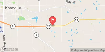
Honey Creek Watershed Site H-3 Reservoir Report
Last Updated: February 4, 2026
Honey Creek Watershed Site H-3 is a vital water resource located in Lucas, Iowa, near Rathbun Reservoir.
°F
°F
mph
Wind
%
Humidity
15-Day Weather Outlook
Summary
Managed by the local government, this site serves multiple purposes including fire protection, stock, and small fish pond, as well as flood risk reduction. The earth dam, standing at a height of 24 feet and stretching 680 feet in length, was completed in 1955 and has a storage capacity of 91 acre-feet. The watershed covers an area of 0.29 square miles with a surface area of 4.8 acres, making it a crucial component of the local water management infrastructure.
The dam at Honey Creek Watershed Site H-3 is regulated by the Iowa Department of Natural Resources and undergoes regular inspections, maintenance, and enforcement measures to ensure its safety and functionality. Classified as having a low hazard potential and a moderate risk assessment score of 3, this site plays a significant role in mitigating flood risks and providing essential water resources to the surrounding area. With its strategic location and purposeful design, the Honey Creek Watershed Site H-3 stands as a testament to effective water resource management and climate adaptation efforts in Iowa.
Enthusiasts of water resources and climate will appreciate the intricate details and significance of Honey Creek Watershed Site H-3 in Lucas, Iowa. From its role in fire protection to flood risk reduction, this site exemplifies the importance of sustainable water management practices. With ongoing regulatory oversight and maintenance measures in place, the dam at Honey Creek Watershed Site H-3 continues to be a critical asset for the community, showcasing the intersection of water resource management and climate resilience in action.
Year Completed |
1955 |
Dam Length |
680 |
Dam Height |
24 |
River Or Stream |
TR-HONEY CREEK |
Primary Dam Type |
Earth |
Surface Area |
4.8 |
Drainage Area |
0.29 |
Nid Storage |
91 |
Hazard Potential |
Low |
Foundations |
Soil |
Nid Height |
24 |
Seasonal Comparison
Hourly Weather Forecast
Nearby Streamflow Levels
Dam Data Reference
Condition Assessment
SatisfactoryNo existing or potential dam safety deficiencies are recognized. Acceptable performance is expected under all loading conditions (static, hydrologic, seismic) in accordance with the minimum applicable state or federal regulatory criteria or tolerable risk guidelines.
Fair
No existing dam safety deficiencies are recognized for normal operating conditions. Rare or extreme hydrologic and/or seismic events may result in a dam safety deficiency. Risk may be in the range to take further action. Note: Rare or extreme event is defined by the regulatory agency based on their minimum
Poor A dam safety deficiency is recognized for normal operating conditions which may realistically occur. Remedial action is necessary. POOR may also be used when uncertainties exist as to critical analysis parameters which identify a potential dam safety deficiency. Investigations and studies are necessary.
Unsatisfactory
A dam safety deficiency is recognized that requires immediate or emergency remedial action for problem resolution.
Not Rated
The dam has not been inspected, is not under state or federal jurisdiction, or has been inspected but, for whatever reason, has not been rated.
Not Available
Dams for which the condition assessment is restricted to approved government users.
Hazard Potential Classification
HighDams assigned the high hazard potential classification are those where failure or mis-operation will probably cause loss of human life.
Significant
Dams assigned the significant hazard potential classification are those dams where failure or mis-operation results in no probable loss of human life but can cause economic loss, environment damage, disruption of lifeline facilities, or impact other concerns. Significant hazard potential classification dams are often located in predominantly rural or agricultural areas but could be in areas with population and significant infrastructure.
Low
Dams assigned the low hazard potential classification are those where failure or mis-operation results in no probable loss of human life and low economic and/or environmental losses. Losses are principally limited to the owner's property.
Undetermined
Dams for which a downstream hazard potential has not been designated or is not provided.
Not Available
Dams for which the downstream hazard potential is restricted to approved government users.


 Honey Creek Watershed Site H-3
 Red Haw Nature Trail Lucas County