Carver Dam Reservoir Report
Nearby: Ballard Country Club Dam Olson Dam
Last Updated: January 7, 2026
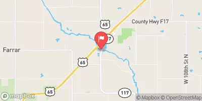
Carver Dam, located in Cambridge, Iowa, was completed in 1991 and serves multiple purposes including fire protection, stock, and small fish pond management.
°F
°F
mph
Wind
%
Humidity
Summary
Owned privately, the dam is regulated by the Iowa Department of Natural Resources and is regularly inspected and enforced for compliance. The earth dam stands at 26 feet high with a length of 220 feet, providing a storage capacity of 57 acre-feet and covering a surface area of 3.8 acres.
The dam, designed by USDA NRCS, is situated on TR- Walnut Creek and falls under the jurisdiction of the Rock Island District. With a low hazard potential and a moderate risk assessment score, Carver Dam has not been rated for its condition and lacks an Emergency Action Plan (EAP). Despite these gaps, the dam meets regulatory guidelines and is operated safely. Water resource and climate enthusiasts can appreciate the strategic location and multifaceted utility of Carver Dam in managing water resources and supporting local ecosystems in Story County, Iowa.
Year Completed |
1991 |
Dam Length |
220 |
Dam Height |
26 |
River Or Stream |
TR- WALNUT CREEK |
Primary Dam Type |
Earth |
Surface Area |
3.8 |
Drainage Area |
0.38 |
Nid Storage |
57 |
Hazard Potential |
Low |
Foundations |
Soil |
Nid Height |
26 |
Seasonal Comparison
Weather Forecast
Nearby Streamflow Levels
Dam Data Reference
Condition Assessment
SatisfactoryNo existing or potential dam safety deficiencies are recognized. Acceptable performance is expected under all loading conditions (static, hydrologic, seismic) in accordance with the minimum applicable state or federal regulatory criteria or tolerable risk guidelines.
Fair
No existing dam safety deficiencies are recognized for normal operating conditions. Rare or extreme hydrologic and/or seismic events may result in a dam safety deficiency. Risk may be in the range to take further action. Note: Rare or extreme event is defined by the regulatory agency based on their minimum
Poor A dam safety deficiency is recognized for normal operating conditions which may realistically occur. Remedial action is necessary. POOR may also be used when uncertainties exist as to critical analysis parameters which identify a potential dam safety deficiency. Investigations and studies are necessary.
Unsatisfactory
A dam safety deficiency is recognized that requires immediate or emergency remedial action for problem resolution.
Not Rated
The dam has not been inspected, is not under state or federal jurisdiction, or has been inspected but, for whatever reason, has not been rated.
Not Available
Dams for which the condition assessment is restricted to approved government users.
Hazard Potential Classification
HighDams assigned the high hazard potential classification are those where failure or mis-operation will probably cause loss of human life.
Significant
Dams assigned the significant hazard potential classification are those dams where failure or mis-operation results in no probable loss of human life but can cause economic loss, environment damage, disruption of lifeline facilities, or impact other concerns. Significant hazard potential classification dams are often located in predominantly rural or agricultural areas but could be in areas with population and significant infrastructure.
Low
Dams assigned the low hazard potential classification are those where failure or mis-operation results in no probable loss of human life and low economic and/or environmental losses. Losses are principally limited to the owner's property.
Undetermined
Dams for which a downstream hazard potential has not been designated or is not provided.
Not Available
Dams for which the downstream hazard potential is restricted to approved government users.


 Carver Dam
 West Riverside Road Story County