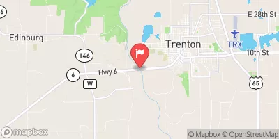
East Fork Big Cr Watershed Site E-14 Reservoir Report
Last Updated: February 4, 2026
Located in Decatur County, Iowa, the East Fork Big Cr Watershed Site E-14 is a crucial flood risk reduction structure designed by the USDA NRCS in 1990.
°F
°F
mph
Wind
%
Humidity
15-Day Weather Outlook
Summary
This earth dam stands at a height of 22 feet and spans 265 feet, with a storage capacity of 101 acre-feet. The dam serves multiple purposes including fire protection, stock, and small fish pond management, in addition to flood risk reduction for the TR- East Fork Big Creek.
Managed by the Iowa DNR, this structure is regulated, permitted, inspected, and enforced by state authorities to ensure its safety and operational effectiveness. With a low hazard potential and a moderate risk assessment rating, the East Fork Big Cr Watershed Site E-14 plays a crucial role in managing water resources and mitigating flood risks in the surrounding area. Located in a rural setting, this site serves as a testament to the collaborative efforts between local government agencies and federal entities like the Natural Resources Conservation Service in safeguarding communities against potential water-related disasters.
As part of the Rock Island District of the USACE, the East Fork Big Cr Watershed Site E-14 exemplifies the importance of proactive water resource management and the integration of sustainable infrastructure for climate resilience. With a focus on risk reduction and community safety, this structure is a vital component of the overall watershed management plan, highlighting the significance of coordinated efforts in preserving and protecting our water resources for future generations.
Year Completed |
1990 |
Dam Length |
265 |
Dam Height |
22 |
River Or Stream |
TR- EAST FORK BIG CREEK |
Primary Dam Type |
Earth |
Surface Area |
5.8 |
Drainage Area |
0.34 |
Nid Storage |
101 |
Hazard Potential |
Low |
Foundations |
Soil |
Nid Height |
22 |
Seasonal Comparison
Hourly Weather Forecast
Nearby Streamflow Levels
Dam Data Reference
Condition Assessment
SatisfactoryNo existing or potential dam safety deficiencies are recognized. Acceptable performance is expected under all loading conditions (static, hydrologic, seismic) in accordance with the minimum applicable state or federal regulatory criteria or tolerable risk guidelines.
Fair
No existing dam safety deficiencies are recognized for normal operating conditions. Rare or extreme hydrologic and/or seismic events may result in a dam safety deficiency. Risk may be in the range to take further action. Note: Rare or extreme event is defined by the regulatory agency based on their minimum
Poor A dam safety deficiency is recognized for normal operating conditions which may realistically occur. Remedial action is necessary. POOR may also be used when uncertainties exist as to critical analysis parameters which identify a potential dam safety deficiency. Investigations and studies are necessary.
Unsatisfactory
A dam safety deficiency is recognized that requires immediate or emergency remedial action for problem resolution.
Not Rated
The dam has not been inspected, is not under state or federal jurisdiction, or has been inspected but, for whatever reason, has not been rated.
Not Available
Dams for which the condition assessment is restricted to approved government users.
Hazard Potential Classification
HighDams assigned the high hazard potential classification are those where failure or mis-operation will probably cause loss of human life.
Significant
Dams assigned the significant hazard potential classification are those dams where failure or mis-operation results in no probable loss of human life but can cause economic loss, environment damage, disruption of lifeline facilities, or impact other concerns. Significant hazard potential classification dams are often located in predominantly rural or agricultural areas but could be in areas with population and significant infrastructure.
Low
Dams assigned the low hazard potential classification are those where failure or mis-operation results in no probable loss of human life and low economic and/or environmental losses. Losses are principally limited to the owner's property.
Undetermined
Dams for which a downstream hazard potential has not been designated or is not provided.
Not Available
Dams for which the downstream hazard potential is restricted to approved government users.


 East Fork Big Cr Watershed Site E-14