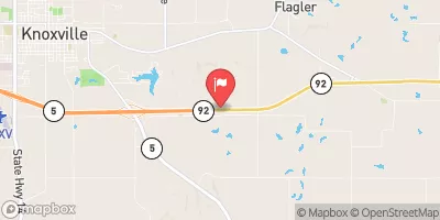
Sims Dam Reservoir Report
Nearby: Cooper Dam Sandy Dam
Last Updated: February 3, 2026
Sims Dam, located in Lucas County, Iowa, was completed in 1988 by the USDA NRCS and is primarily used for fire protection, stock, or as a small fish pond.
°F
°F
mph
Wind
%
Humidity
15-Day Weather Outlook
Summary
This earth dam stands at a height of 36 feet and has a length of 220 feet, with a storage capacity of 25 acre-feet. Situated on TR- Whites Creek, the dam is regulated by the Iowa DNR and is subject to state permitting, inspection, and enforcement.
With a low hazard potential and a moderate risk assessment rating, Sims Dam serves as a crucial resource for water management in the area. Despite not having a current condition assessment, the dam is in operation and meets the guidelines for emergency action plans. While the dam does not have an inundation map prepared, it is equipped with an uncontrolled spillway and is under the jurisdiction of the Kansas City District of the USACE.
As a vital infrastructure for water resource management in the region, Sims Dam provides essential services for fire protection and agricultural needs. With its strategic location on TR- Whites Creek, this earth dam continues to play a key role in water conservation efforts, supported by the oversight of the Iowa DNR and the USDA NRCS.
Year Completed |
1988 |
Dam Length |
220 |
Dam Height |
36 |
River Or Stream |
TR- WHITES CREEK |
Primary Dam Type |
Earth |
Surface Area |
1 |
Drainage Area |
0.1 |
Nid Storage |
25 |
Hazard Potential |
Low |
Foundations |
Soil |
Nid Height |
36 |
Seasonal Comparison
Hourly Weather Forecast
Nearby Streamflow Levels
Dam Data Reference
Condition Assessment
SatisfactoryNo existing or potential dam safety deficiencies are recognized. Acceptable performance is expected under all loading conditions (static, hydrologic, seismic) in accordance with the minimum applicable state or federal regulatory criteria or tolerable risk guidelines.
Fair
No existing dam safety deficiencies are recognized for normal operating conditions. Rare or extreme hydrologic and/or seismic events may result in a dam safety deficiency. Risk may be in the range to take further action. Note: Rare or extreme event is defined by the regulatory agency based on their minimum
Poor A dam safety deficiency is recognized for normal operating conditions which may realistically occur. Remedial action is necessary. POOR may also be used when uncertainties exist as to critical analysis parameters which identify a potential dam safety deficiency. Investigations and studies are necessary.
Unsatisfactory
A dam safety deficiency is recognized that requires immediate or emergency remedial action for problem resolution.
Not Rated
The dam has not been inspected, is not under state or federal jurisdiction, or has been inspected but, for whatever reason, has not been rated.
Not Available
Dams for which the condition assessment is restricted to approved government users.
Hazard Potential Classification
HighDams assigned the high hazard potential classification are those where failure or mis-operation will probably cause loss of human life.
Significant
Dams assigned the significant hazard potential classification are those dams where failure or mis-operation results in no probable loss of human life but can cause economic loss, environment damage, disruption of lifeline facilities, or impact other concerns. Significant hazard potential classification dams are often located in predominantly rural or agricultural areas but could be in areas with population and significant infrastructure.
Low
Dams assigned the low hazard potential classification are those where failure or mis-operation results in no probable loss of human life and low economic and/or environmental losses. Losses are principally limited to the owner's property.
Undetermined
Dams for which a downstream hazard potential has not been designated or is not provided.
Not Available
Dams for which the downstream hazard potential is restricted to approved government users.


 Sims Dam