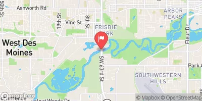
Silliman Dam Reservoir Report
Last Updated: February 5, 2026
Silliman Dam, located in Madison County, Iowa, is a private-owned earth dam constructed in 1995 by the USDA NRCS.
°F
°F
mph
Wind
%
Humidity
15-Day Weather Outlook
Summary
With a height of 36 feet and a length of 590 feet, this dam primarily serves the purposes of fire protection, livestock, and small fish pond management. It has a storage capacity of 33 acre-feet and covers a surface area of 1 acre, with a drainage area of 0.23 square miles.
Despite being classified as a low-hazard dam with a moderate risk assessment, Silliman Dam is regulated, permitted, inspected, and enforced by the Iowa Department of Natural Resources. The dam features an uncontrolled spillway type and is situated on the TR- North River. The surrounding area is under the jurisdiction of the Kansas City District of the US Army Corps of Engineers. Its condition assessment is currently not rated, and there is no emergency action plan in place.
For water resource and climate enthusiasts, Silliman Dam offers an intriguing case study in dam infrastructure management and risk assessment. Its strategic location and design make it a crucial asset for local water management and conservation efforts. As stakeholders continue to monitor and maintain this structure, it serves as a reminder of the importance of sustainable water resource practices in mitigating potential hazards and ensuring environmental resilience in the face of changing climate patterns.
Year Completed |
1995 |
Dam Length |
590 |
Dam Height |
36 |
River Or Stream |
TR- NORTH RIVER |
Primary Dam Type |
Earth |
Surface Area |
1 |
Drainage Area |
0.23 |
Nid Storage |
33 |
Hazard Potential |
Low |
Foundations |
Soil |
Nid Height |
36 |
Seasonal Comparison
Hourly Weather Forecast
Nearby Streamflow Levels
 North River Near Norwalk
|
48cfs |
 Raccoon River Near West Des Moines
|
1300cfs |
 Raccoon River At Van Meter
|
1640cfs |
 Middle River Near Indianola
|
48cfs |
 Raccoon River At 63rd Street At Des Moines
|
587cfs |
 Walnut Creek At Des Moines
|
10cfs |
Dam Data Reference
Condition Assessment
SatisfactoryNo existing or potential dam safety deficiencies are recognized. Acceptable performance is expected under all loading conditions (static, hydrologic, seismic) in accordance with the minimum applicable state or federal regulatory criteria or tolerable risk guidelines.
Fair
No existing dam safety deficiencies are recognized for normal operating conditions. Rare or extreme hydrologic and/or seismic events may result in a dam safety deficiency. Risk may be in the range to take further action. Note: Rare or extreme event is defined by the regulatory agency based on their minimum
Poor A dam safety deficiency is recognized for normal operating conditions which may realistically occur. Remedial action is necessary. POOR may also be used when uncertainties exist as to critical analysis parameters which identify a potential dam safety deficiency. Investigations and studies are necessary.
Unsatisfactory
A dam safety deficiency is recognized that requires immediate or emergency remedial action for problem resolution.
Not Rated
The dam has not been inspected, is not under state or federal jurisdiction, or has been inspected but, for whatever reason, has not been rated.
Not Available
Dams for which the condition assessment is restricted to approved government users.
Hazard Potential Classification
HighDams assigned the high hazard potential classification are those where failure or mis-operation will probably cause loss of human life.
Significant
Dams assigned the significant hazard potential classification are those dams where failure or mis-operation results in no probable loss of human life but can cause economic loss, environment damage, disruption of lifeline facilities, or impact other concerns. Significant hazard potential classification dams are often located in predominantly rural or agricultural areas but could be in areas with population and significant infrastructure.
Low
Dams assigned the low hazard potential classification are those where failure or mis-operation results in no probable loss of human life and low economic and/or environmental losses. Losses are principally limited to the owner's property.
Undetermined
Dams for which a downstream hazard potential has not been designated or is not provided.
Not Available
Dams for which the downstream hazard potential is restricted to approved government users.

 Silliman Dam