Summary
This private dam on TR- Cedar Creek stands at a height of 30 feet and has a length of 325 feet, providing a storage capacity of 44 acre-feet. Despite its low hazard potential, the dam is regulated by the Iowa DNR and undergoes regular state inspections and enforcement to ensure its safety and compliance with regulations.
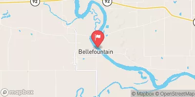
With a moderate risk assessment rating of 3, Dyson Dam is considered to have a manageable level of risk. The dam's earth structure and soil foundation contribute to its stability, while its uncontrolled spillway design helps regulate water flow during times of high discharge. The dam's location in Monroe County, Iowa, adds to its significance as a water resource for the local community, offering both practical benefits and recreational opportunities for residents and visitors alike.
As a key feature in the water management system of the area, Dyson Dam plays a crucial role in maintaining water levels for fire protection, livestock, and small fish pond purposes. Its presence underscores the importance of sustainable water resource management in the face of changing climate patterns, making it a notable site for water resource and climate enthusiasts to observe and study.
Year Completed |
1991 |
Dam Length |
325 |
Dam Height |
30 |
River Or Stream |
TR- CEDAR CREEK |
Primary Dam Type |
Earth |
Surface Area |
2 |
Drainage Area |
0.24 |
Nid Storage |
44 |
Hazard Potential |
Low |
Foundations |
Soil |
Nid Height |
30 |
Seasonal Comparison
Hourly Weather Forecast
Nearby Streamflow Levels
Dam Data Reference
Condition Assessment
SatisfactoryNo existing or potential dam safety deficiencies are recognized. Acceptable performance is expected under all loading conditions (static, hydrologic, seismic) in accordance with the minimum applicable state or federal regulatory criteria or tolerable risk guidelines.
Fair
No existing dam safety deficiencies are recognized for normal operating conditions. Rare or extreme hydrologic and/or seismic events may result in a dam safety deficiency. Risk may be in the range to take further action. Note: Rare or extreme event is defined by the regulatory agency based on their minimum
Poor A dam safety deficiency is recognized for normal operating conditions which may realistically occur. Remedial action is necessary. POOR may also be used when uncertainties exist as to critical analysis parameters which identify a potential dam safety deficiency. Investigations and studies are necessary.
Unsatisfactory
A dam safety deficiency is recognized that requires immediate or emergency remedial action for problem resolution.
Not Rated
The dam has not been inspected, is not under state or federal jurisdiction, or has been inspected but, for whatever reason, has not been rated.
Not Available
Dams for which the condition assessment is restricted to approved government users.
Hazard Potential Classification
HighDams assigned the high hazard potential classification are those where failure or mis-operation will probably cause loss of human life.
Significant
Dams assigned the significant hazard potential classification are those dams where failure or mis-operation results in no probable loss of human life but can cause economic loss, environment damage, disruption of lifeline facilities, or impact other concerns. Significant hazard potential classification dams are often located in predominantly rural or agricultural areas but could be in areas with population and significant infrastructure.
Low
Dams assigned the low hazard potential classification are those where failure or mis-operation results in no probable loss of human life and low economic and/or environmental losses. Losses are principally limited to the owner's property.
Undetermined
Dams for which a downstream hazard potential has not been designated or is not provided.
Not Available
Dams for which the downstream hazard potential is restricted to approved government users.


 Dyson Dam
 Rathbun Lake Near Rathbun
 Avian Court Appanoose County