South 6th St Stormwater Detention Basin Reservoir Report
Last Updated: January 11, 2026
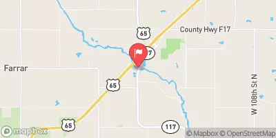
Located in Marshalltown, Iowa, the South 6th St Stormwater Detention Basin is a vital structure designed by VEENSTRA & KIMM to assist in flood risk reduction along Anson Creek.
°F
°F
mph
Wind
%
Humidity
Summary
Completed in 1997, this earth dam stands at a height of 9 feet and spans a length of 220 feet, with a capacity to store 69 acre-feet of water. With a primary purpose of flood risk reduction, this basin plays a crucial role in managing stormwater during heavy rainfall events.
Owned and regulated by the local government, the South 6th St Stormwater Detention Basin is under the jurisdiction of the Iowa Department of Natural Resources. Despite its low hazard potential and moderate risk assessment, the structure has not been rated for its condition assessment. However, it serves as a key asset in protecting the surrounding area from potential flooding, with a normal storage capacity of 32 acre-feet and a surface area of 4.3 acres.
With its uncontrolled spillway type and location in a designated flood risk area, the South 6th St Stormwater Detention Basin stands as a critical infrastructure for water resource and climate enthusiasts. As a key component in the flood risk reduction strategy for Marshalltown, this earth dam plays a crucial role in managing stormwater flow and protecting the community from potential flood events along Anson Creek.
Year Completed |
1997 |
Dam Length |
220 |
Dam Height |
9 |
River Or Stream |
ANSON CREEK |
Primary Dam Type |
Earth |
Surface Area |
4.3 |
Drainage Area |
0.33 |
Nid Storage |
69 |
Hazard Potential |
Low |
Foundations |
Soil |
Nid Height |
9 |
Seasonal Comparison
Weather Forecast
Nearby Streamflow Levels
 Timber Creek Near Marshalltown
|
37cfs |
 Iowa River At Marshalltown
|
1040cfs |
 South Fork Iowa River Ne Of New Providence
|
79cfs |
 Richland Creek Near Haven
|
12cfs |
 Indian Creek Near Mingo
|
79cfs |
 South Skunk River At Colfax
|
211cfs |
Dam Data Reference
Condition Assessment
SatisfactoryNo existing or potential dam safety deficiencies are recognized. Acceptable performance is expected under all loading conditions (static, hydrologic, seismic) in accordance with the minimum applicable state or federal regulatory criteria or tolerable risk guidelines.
Fair
No existing dam safety deficiencies are recognized for normal operating conditions. Rare or extreme hydrologic and/or seismic events may result in a dam safety deficiency. Risk may be in the range to take further action. Note: Rare or extreme event is defined by the regulatory agency based on their minimum
Poor A dam safety deficiency is recognized for normal operating conditions which may realistically occur. Remedial action is necessary. POOR may also be used when uncertainties exist as to critical analysis parameters which identify a potential dam safety deficiency. Investigations and studies are necessary.
Unsatisfactory
A dam safety deficiency is recognized that requires immediate or emergency remedial action for problem resolution.
Not Rated
The dam has not been inspected, is not under state or federal jurisdiction, or has been inspected but, for whatever reason, has not been rated.
Not Available
Dams for which the condition assessment is restricted to approved government users.
Hazard Potential Classification
HighDams assigned the high hazard potential classification are those where failure or mis-operation will probably cause loss of human life.
Significant
Dams assigned the significant hazard potential classification are those dams where failure or mis-operation results in no probable loss of human life but can cause economic loss, environment damage, disruption of lifeline facilities, or impact other concerns. Significant hazard potential classification dams are often located in predominantly rural or agricultural areas but could be in areas with population and significant infrastructure.
Low
Dams assigned the low hazard potential classification are those where failure or mis-operation results in no probable loss of human life and low economic and/or environmental losses. Losses are principally limited to the owner's property.
Undetermined
Dams for which a downstream hazard potential has not been designated or is not provided.
Not Available
Dams for which the downstream hazard potential is restricted to approved government users.
Area Campgrounds
| Location | Reservations | Toilets |
|---|---|---|
 Riverview Park - Marshalltown
|
||
 Timmons Grove County Park
|
||
 Grammer Grove Wildlife Area
|

 South 6th St Stormwater Detention Basin