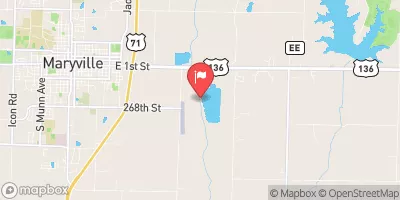
Shreck Dam Reservoir Report
Nearby: Smith Dam Blockton Watershed Site T-1
Last Updated: February 6, 2026
Shreck Dam, located in Ringgold County, Iowa, was completed in 1998 by the Natural Resources Conservation Service (NRCS) and serves multiple purposes including fire protection and maintaining a small fish pond.
Summary
This earth dam stands at a height of 36 feet and spans 440 feet in length, with a maximum storage capacity of 66 acre-feet. Despite its low hazard potential, the dam is regulated by the Iowa Department of Natural Resources and undergoes regular inspections to ensure its safety and compliance with state regulations.
Situated on the TR-Grand River, Shreck Dam plays a crucial role in managing water resources in the region, with a surface area of 4.8 acres and a drainage area of 0.34 square miles. While the dam has an uncontrolled spillway type, its risk assessment is classified as moderate (3), indicating a level of risk that requires ongoing monitoring and potential management measures. The dam's location in a private ownership setting underscores the importance of collaboration between private owners and state regulatory agencies to ensure the safety and sustainability of water infrastructure in the area.
With its strategic location and primary purpose of water management, Shreck Dam serves as a vital asset for fire protection and supporting local ecosystems. As a key feature in the Rock Island District, the dam's construction and regulation highlight the importance of balancing water resource management with environmental conservation efforts. Climate and water resource enthusiasts will find Shreck Dam to be a fascinating case study in sustainable infrastructure development and the intersection of public and private sector responsibilities in ensuring the resilience of water systems in the face of climate change challenges.
°F
°F
mph
Wind
%
Humidity
15-Day Weather Outlook
Year Completed |
1998 |
Dam Length |
440 |
Dam Height |
36 |
River Or Stream |
TR- GRAND RIVER |
Primary Dam Type |
Earth |
Surface Area |
4.8 |
Drainage Area |
0.34 |
Nid Storage |
66 |
Hazard Potential |
Low |
Foundations |
Soil |
Nid Height |
36 |
Seasonal Comparison
5-Day Hourly Forecast Detail
Nearby Streamflow Levels
Dam Data Reference
Condition Assessment
SatisfactoryNo existing or potential dam safety deficiencies are recognized. Acceptable performance is expected under all loading conditions (static, hydrologic, seismic) in accordance with the minimum applicable state or federal regulatory criteria or tolerable risk guidelines.
Fair
No existing dam safety deficiencies are recognized for normal operating conditions. Rare or extreme hydrologic and/or seismic events may result in a dam safety deficiency. Risk may be in the range to take further action. Note: Rare or extreme event is defined by the regulatory agency based on their minimum
Poor A dam safety deficiency is recognized for normal operating conditions which may realistically occur. Remedial action is necessary. POOR may also be used when uncertainties exist as to critical analysis parameters which identify a potential dam safety deficiency. Investigations and studies are necessary.
Unsatisfactory
A dam safety deficiency is recognized that requires immediate or emergency remedial action for problem resolution.
Not Rated
The dam has not been inspected, is not under state or federal jurisdiction, or has been inspected but, for whatever reason, has not been rated.
Not Available
Dams for which the condition assessment is restricted to approved government users.
Hazard Potential Classification
HighDams assigned the high hazard potential classification are those where failure or mis-operation will probably cause loss of human life.
Significant
Dams assigned the significant hazard potential classification are those dams where failure or mis-operation results in no probable loss of human life but can cause economic loss, environment damage, disruption of lifeline facilities, or impact other concerns. Significant hazard potential classification dams are often located in predominantly rural or agricultural areas but could be in areas with population and significant infrastructure.
Low
Dams assigned the low hazard potential classification are those where failure or mis-operation results in no probable loss of human life and low economic and/or environmental losses. Losses are principally limited to the owner's property.
Undetermined
Dams for which a downstream hazard potential has not been designated or is not provided.
Not Available
Dams for which the downstream hazard potential is restricted to approved government users.


 Shreck Dam