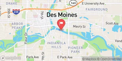
Se Des Moines Stormwater Det. Dam #8 Reservoir Report
Last Updated: February 5, 2026
Se Des Moines Stormwater Det.
°F
°F
mph
Wind
%
Humidity
15-Day Weather Outlook
Summary
Dam #8, located in Des Moines, Iowa, was completed in 1999 by Snyder & Associates with the primary purpose of flood risk reduction. This earth dam is situated on the TR-Yeader Creek and is regulated by the Iowa Department of Natural Resources. With a dam height of 23 feet and a length of 530 feet, it provides a storage capacity of 65 acre-feet, serving as a vital structure for managing stormwater in the area.
The dam has a low hazard potential and is currently in satisfactory condition as per the last assessment in 2010. It has a surface area of 2.1 acres and a drainage area of 0.36 square miles. The spillway, with a width of 8 feet, is uncontrolled, and the dam is designed to handle moderate risk levels. Despite not having associated locks or gates, the dam plays a crucial role in mitigating flood risks and protecting the surrounding community from potential water-related hazards.
Owned and regulated by the local government, Se Des Moines Stormwater Det. Dam #8 exemplifies successful collaboration between stakeholders in ensuring water resource management. With its strategic location and design features, this dam stands as a testament to effective flood control measures in the region, serving as a crucial asset in safeguarding against climate-related challenges.
Year Completed |
1999 |
Dam Length |
530 |
Dam Height |
23 |
River Or Stream |
TR- YEADER CREEK |
Primary Dam Type |
Earth |
Surface Area |
2.1 |
Drainage Area |
0.36 |
Nid Storage |
65 |
Hazard Potential |
Low |
Foundations |
Soil |
Nid Height |
23 |
Seasonal Comparison
Hourly Weather Forecast
Nearby Streamflow Levels
 Des Moines River Blw Raccoon Riv At Des Moines
|
1010cfs |
 Raccoon River At Fleur Drive
|
1200cfs |
 Fourmile Creek At Des Moines
|
22cfs |
 Des Moines River At 2nd Avenue
|
418cfs |
 North River Near Norwalk
|
48cfs |
 Middle River Near Indianola
|
48cfs |
Dam Data Reference
Condition Assessment
SatisfactoryNo existing or potential dam safety deficiencies are recognized. Acceptable performance is expected under all loading conditions (static, hydrologic, seismic) in accordance with the minimum applicable state or federal regulatory criteria or tolerable risk guidelines.
Fair
No existing dam safety deficiencies are recognized for normal operating conditions. Rare or extreme hydrologic and/or seismic events may result in a dam safety deficiency. Risk may be in the range to take further action. Note: Rare or extreme event is defined by the regulatory agency based on their minimum
Poor A dam safety deficiency is recognized for normal operating conditions which may realistically occur. Remedial action is necessary. POOR may also be used when uncertainties exist as to critical analysis parameters which identify a potential dam safety deficiency. Investigations and studies are necessary.
Unsatisfactory
A dam safety deficiency is recognized that requires immediate or emergency remedial action for problem resolution.
Not Rated
The dam has not been inspected, is not under state or federal jurisdiction, or has been inspected but, for whatever reason, has not been rated.
Not Available
Dams for which the condition assessment is restricted to approved government users.
Hazard Potential Classification
HighDams assigned the high hazard potential classification are those where failure or mis-operation will probably cause loss of human life.
Significant
Dams assigned the significant hazard potential classification are those dams where failure or mis-operation results in no probable loss of human life but can cause economic loss, environment damage, disruption of lifeline facilities, or impact other concerns. Significant hazard potential classification dams are often located in predominantly rural or agricultural areas but could be in areas with population and significant infrastructure.
Low
Dams assigned the low hazard potential classification are those where failure or mis-operation results in no probable loss of human life and low economic and/or environmental losses. Losses are principally limited to the owner's property.
Undetermined
Dams for which a downstream hazard potential has not been designated or is not provided.
Not Available
Dams for which the downstream hazard potential is restricted to approved government users.

 Se Des Moines Stormwater Det. Dam #8
 County Park Des Moines