Upper Locust Watershed Site L-47 Reservoir Report
Last Updated: February 4, 2026
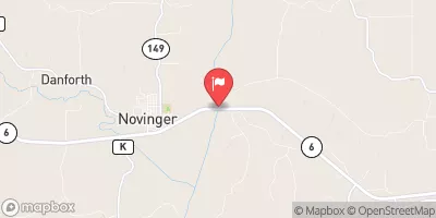
Upper Locust Watershed Site L-47, located in Wayne County, Iowa, is a crucial water resource managed by the local government for purposes such as fire protection, stock, and small fish pond maintenance.
°F
°F
mph
Wind
%
Humidity
15-Day Weather Outlook
Summary
This earth dam, constructed in 1999 by the USDA NRCS, stands at a height of 25 feet and has a storage capacity of 93 acre-feet. With a low hazard potential and a moderate risk assessment rating of 3, this dam plays a vital role in flood risk reduction for the area.
The dam sits on TR-LOCUST CREEK and is under the regulatory jurisdiction of the Iowa Department of Natural Resources. Despite not having a current condition assessment, the dam's structural integrity is deemed sufficient for its intended purposes. With a surface area of 4 acres and a drainage area of 0.29 square miles, this site serves as a valuable asset for water conservation and management in the region. Water resource and climate enthusiasts can appreciate the importance of Upper Locust Watershed Site L-47 in safeguarding the local ecosystem and supporting sustainable water usage practices.
Year Completed |
1999 |
Dam Length |
534 |
Dam Height |
25 |
River Or Stream |
TR- LOCUST CREEK |
Primary Dam Type |
Earth |
Surface Area |
4 |
Drainage Area |
0.29 |
Nid Storage |
93 |
Hazard Potential |
Low |
Foundations |
Soil |
Nid Height |
25 |
Seasonal Comparison
Hourly Weather Forecast
Nearby Streamflow Levels
Dam Data Reference
Condition Assessment
SatisfactoryNo existing or potential dam safety deficiencies are recognized. Acceptable performance is expected under all loading conditions (static, hydrologic, seismic) in accordance with the minimum applicable state or federal regulatory criteria or tolerable risk guidelines.
Fair
No existing dam safety deficiencies are recognized for normal operating conditions. Rare or extreme hydrologic and/or seismic events may result in a dam safety deficiency. Risk may be in the range to take further action. Note: Rare or extreme event is defined by the regulatory agency based on their minimum
Poor A dam safety deficiency is recognized for normal operating conditions which may realistically occur. Remedial action is necessary. POOR may also be used when uncertainties exist as to critical analysis parameters which identify a potential dam safety deficiency. Investigations and studies are necessary.
Unsatisfactory
A dam safety deficiency is recognized that requires immediate or emergency remedial action for problem resolution.
Not Rated
The dam has not been inspected, is not under state or federal jurisdiction, or has been inspected but, for whatever reason, has not been rated.
Not Available
Dams for which the condition assessment is restricted to approved government users.
Hazard Potential Classification
HighDams assigned the high hazard potential classification are those where failure or mis-operation will probably cause loss of human life.
Significant
Dams assigned the significant hazard potential classification are those dams where failure or mis-operation results in no probable loss of human life but can cause economic loss, environment damage, disruption of lifeline facilities, or impact other concerns. Significant hazard potential classification dams are often located in predominantly rural or agricultural areas but could be in areas with population and significant infrastructure.
Low
Dams assigned the low hazard potential classification are those where failure or mis-operation results in no probable loss of human life and low economic and/or environmental losses. Losses are principally limited to the owner's property.
Undetermined
Dams for which a downstream hazard potential has not been designated or is not provided.
Not Available
Dams for which the downstream hazard potential is restricted to approved government users.


 Upper Locust Watershed Site L-47