Wilhelmi Dam Reservoir Report
Nearby: Lanning Dam Midwest Oilseed Dam #2
Last Updated: January 13, 2026
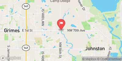
Wilhelmi Dam, located in Adel, Iowa, is a privately owned structure designed by the USDA NRCS and regulated by the Iowa Department of Natural Resources.
°F
°F
mph
Wind
%
Humidity
Summary
Completed in 2002, this earth dam stands at a height of 30 feet and stretches 425 feet in length, with a maximum storage capacity of 88 acre-feet. Its primary purpose is for fire protection, stock, or small fish pond use, serving as a vital resource for the local community.
Situated on the TR- North Raccoon River, Wilhelmi Dam has a surface area of 5.9 acres and a drainage area of 0.21 square miles. With a low hazard potential and moderate risk assessment, this dam plays a crucial role in water resource management in Dallas County, Iowa. Despite its relatively small size, Wilhelmi Dam serves as an important infrastructure for maintaining water supply, especially during times of dry spells or emergencies.
With its uncontrolled spillway type and soil foundation, Wilhelmi Dam exemplifies the collaboration between private ownership, federal agencies, and state regulators in ensuring water safety and management. As a key component of the local ecosystem and watershed, this dam underscores the importance of sustainable water resource practices and climate resilience in the face of changing environmental conditions.
Year Completed |
2002 |
Dam Length |
425 |
Dam Height |
30 |
River Or Stream |
TR- NORTH RACCOON RIVER |
Primary Dam Type |
Earth |
Surface Area |
5.9 |
Drainage Area |
0.21 |
Nid Storage |
88 |
Hazard Potential |
Low |
Foundations |
Soil |
Nid Height |
30 |
Seasonal Comparison
Weather Forecast
Nearby Streamflow Levels
 South Raccoon River At Redfield
|
268cfs |
 Middle Raccoon River At Panora
|
92cfs |
 Raccoon River At Van Meter
|
1640cfs |
 Beaver Creek Near Grimes
|
183cfs |
 Middle Raccoon River Near Bayard
|
121cfs |
 North Raccoon River Near Jefferson
|
530cfs |
Dam Data Reference
Condition Assessment
SatisfactoryNo existing or potential dam safety deficiencies are recognized. Acceptable performance is expected under all loading conditions (static, hydrologic, seismic) in accordance with the minimum applicable state or federal regulatory criteria or tolerable risk guidelines.
Fair
No existing dam safety deficiencies are recognized for normal operating conditions. Rare or extreme hydrologic and/or seismic events may result in a dam safety deficiency. Risk may be in the range to take further action. Note: Rare or extreme event is defined by the regulatory agency based on their minimum
Poor A dam safety deficiency is recognized for normal operating conditions which may realistically occur. Remedial action is necessary. POOR may also be used when uncertainties exist as to critical analysis parameters which identify a potential dam safety deficiency. Investigations and studies are necessary.
Unsatisfactory
A dam safety deficiency is recognized that requires immediate or emergency remedial action for problem resolution.
Not Rated
The dam has not been inspected, is not under state or federal jurisdiction, or has been inspected but, for whatever reason, has not been rated.
Not Available
Dams for which the condition assessment is restricted to approved government users.
Hazard Potential Classification
HighDams assigned the high hazard potential classification are those where failure or mis-operation will probably cause loss of human life.
Significant
Dams assigned the significant hazard potential classification are those dams where failure or mis-operation results in no probable loss of human life but can cause economic loss, environment damage, disruption of lifeline facilities, or impact other concerns. Significant hazard potential classification dams are often located in predominantly rural or agricultural areas but could be in areas with population and significant infrastructure.
Low
Dams assigned the low hazard potential classification are those where failure or mis-operation results in no probable loss of human life and low economic and/or environmental losses. Losses are principally limited to the owner's property.
Undetermined
Dams for which a downstream hazard potential has not been designated or is not provided.
Not Available
Dams for which the downstream hazard potential is restricted to approved government users.

 Wilhelmi Dam