Davis Dam Reservoir Report
Last Updated: February 4, 2026
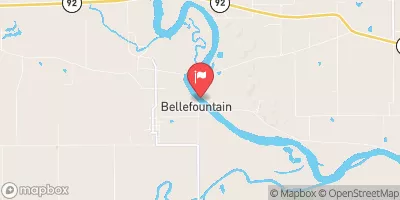
Davis Dam, located in Hiteman, Iowa, is a private-owned structure designed by USDA NRCS with the primary purpose of grade stabilization.
°F
°F
mph
Wind
%
Humidity
15-Day Weather Outlook
Summary
Completed in 2004, this earth dam stands at a height of 30 feet and spans a length of 260 feet, with a storage capacity of 27 acre-feet. The dam serves various purposes including fire protection, stock, or small fish pond, in addition to its primary function.
Situated on Tr- Coal Creek in Monroe County, Iowa, Davis Dam plays a crucial role in managing water resources and mitigating the risk of flooding in the region. With a low hazard potential and a condition assessment that is currently not rated, the dam provides essential infrastructure for the community. Despite not being federally regulated or inspected, the dam serves as a vital component of the local water management system.
Although Davis Dam has not been assessed for its emergency action plan or risk management measures, its construction and design signify a commitment to environmental stewardship and water resource management. With its strategic location and storage capabilities, Davis Dam stands as a testament to the importance of sustainable water infrastructure in mitigating the impacts of climate change and ensuring the resilience of communities in the face of environmental challenges.
Year Completed |
2004 |
Dam Length |
260 |
Dam Height |
30 |
River Or Stream |
Tr- Coal Creek |
Primary Dam Type |
Earth |
Surface Area |
2 |
Drainage Area |
0.06 |
Nid Storage |
27 |
Hazard Potential |
Low |
Foundations |
Soil |
Nid Height |
30 |
Seasonal Comparison
Hourly Weather Forecast
Nearby Streamflow Levels
 Chariton River Near Rathbun
|
11cfs |
 Cedar Creek Near Bussey
|
11cfs |
 Chariton River Near Moulton
|
34cfs |
 Des Moines River At Ottumwa
|
1090cfs |
 Des Moines River Near Tracy
|
1400cfs |
 South Fork Chariton River Near Promise City
|
4cfs |
Dam Data Reference
Condition Assessment
SatisfactoryNo existing or potential dam safety deficiencies are recognized. Acceptable performance is expected under all loading conditions (static, hydrologic, seismic) in accordance with the minimum applicable state or federal regulatory criteria or tolerable risk guidelines.
Fair
No existing dam safety deficiencies are recognized for normal operating conditions. Rare or extreme hydrologic and/or seismic events may result in a dam safety deficiency. Risk may be in the range to take further action. Note: Rare or extreme event is defined by the regulatory agency based on their minimum
Poor A dam safety deficiency is recognized for normal operating conditions which may realistically occur. Remedial action is necessary. POOR may also be used when uncertainties exist as to critical analysis parameters which identify a potential dam safety deficiency. Investigations and studies are necessary.
Unsatisfactory
A dam safety deficiency is recognized that requires immediate or emergency remedial action for problem resolution.
Not Rated
The dam has not been inspected, is not under state or federal jurisdiction, or has been inspected but, for whatever reason, has not been rated.
Not Available
Dams for which the condition assessment is restricted to approved government users.
Hazard Potential Classification
HighDams assigned the high hazard potential classification are those where failure or mis-operation will probably cause loss of human life.
Significant
Dams assigned the significant hazard potential classification are those dams where failure or mis-operation results in no probable loss of human life but can cause economic loss, environment damage, disruption of lifeline facilities, or impact other concerns. Significant hazard potential classification dams are often located in predominantly rural or agricultural areas but could be in areas with population and significant infrastructure.
Low
Dams assigned the low hazard potential classification are those where failure or mis-operation results in no probable loss of human life and low economic and/or environmental losses. Losses are principally limited to the owner's property.
Undetermined
Dams for which a downstream hazard potential has not been designated or is not provided.
Not Available
Dams for which the downstream hazard potential is restricted to approved government users.

 Davis Dam
 Rathbun Lake Near Rathbun
 200th Avenue Appanoose County