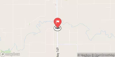
Newquist Grade Stabilization Structure Reservoir Report
Nearby: Greiner Dam Mc Carroll Dam
Last Updated: February 2, 2026
The Newquist Grade Stabilization Structure, located in Fairfield, Iowa, is a private-owned earth dam designed by USDA NRCS to address flood risk reduction and grade stabilization along a tributary to Buckeye Creek.
°F
°F
mph
Wind
%
Humidity
15-Day Weather Outlook
Summary
Completed in 2011, this structure stands at 27 feet high and stretches 569 feet in length, with a storage capacity of 612 acre-feet and a drainage area of 2.2 square miles. Despite being categorized with a low hazard potential and not yet rated for condition assessment, the dam serves a crucial role in protecting the surrounding area from potential flooding events.
Operated under state jurisdiction by the Iowa DNR, the Newquist Grade Stabilization Structure undergoes regular state permitting, inspection, and enforcement to ensure its safety and effectiveness. With a primary purpose of grade stabilization, the dam contributes to the overall flood risk reduction efforts in the region. Although lacking detailed information on emergency action plans and risk management measures, the structure remains a key component in the local water resource management system, providing essential protection to the community and environment.
Situated in Wapello County, Iowa, the Newquist Structure plays a vital role in managing water flow and reducing the risk of flooding in the area. With a close proximity to the Rock Island District, this earth dam serves as a valuable asset in safeguarding the local community against potential water-related hazards. As water resource and climate enthusiasts, the Newquist Grade Stabilization Structure stands as a testament to the importance of sustainable infrastructure in mitigating the impacts of extreme weather events and ensuring the resilience of our natural environment.
Year Completed |
2011 |
Dam Length |
569 |
Dam Height |
27 |
River Or Stream |
Trib to Buckeye Creek |
Primary Dam Type |
Earth |
Surface Area |
21 |
Drainage Area |
2.2 |
Nid Storage |
612 |
Outlet Gates |
None |
Hazard Potential |
Low |
Foundations |
Soil |
Nid Height |
27 |
Seasonal Comparison
Hourly Weather Forecast
Nearby Streamflow Levels
 Des Moines River At Ottumwa
|
1090cfs |
 Fox River At Bloomfield
|
7cfs |
 North Skunk River Near Sigourney
|
97cfs |
 Des Moines River At Keosauqua
|
1800cfs |
 South Skunk River Near Oskaloosa
|
485cfs |
 Cedar Creek Near Oakland Mills
|
10cfs |
Dam Data Reference
Condition Assessment
SatisfactoryNo existing or potential dam safety deficiencies are recognized. Acceptable performance is expected under all loading conditions (static, hydrologic, seismic) in accordance with the minimum applicable state or federal regulatory criteria or tolerable risk guidelines.
Fair
No existing dam safety deficiencies are recognized for normal operating conditions. Rare or extreme hydrologic and/or seismic events may result in a dam safety deficiency. Risk may be in the range to take further action. Note: Rare or extreme event is defined by the regulatory agency based on their minimum
Poor A dam safety deficiency is recognized for normal operating conditions which may realistically occur. Remedial action is necessary. POOR may also be used when uncertainties exist as to critical analysis parameters which identify a potential dam safety deficiency. Investigations and studies are necessary.
Unsatisfactory
A dam safety deficiency is recognized that requires immediate or emergency remedial action for problem resolution.
Not Rated
The dam has not been inspected, is not under state or federal jurisdiction, or has been inspected but, for whatever reason, has not been rated.
Not Available
Dams for which the condition assessment is restricted to approved government users.
Hazard Potential Classification
HighDams assigned the high hazard potential classification are those where failure or mis-operation will probably cause loss of human life.
Significant
Dams assigned the significant hazard potential classification are those dams where failure or mis-operation results in no probable loss of human life but can cause economic loss, environment damage, disruption of lifeline facilities, or impact other concerns. Significant hazard potential classification dams are often located in predominantly rural or agricultural areas but could be in areas with population and significant infrastructure.
Low
Dams assigned the low hazard potential classification are those where failure or mis-operation results in no probable loss of human life and low economic and/or environmental losses. Losses are principally limited to the owner's property.
Undetermined
Dams for which a downstream hazard potential has not been designated or is not provided.
Not Available
Dams for which the downstream hazard potential is restricted to approved government users.

 Newquist Grade Stabilization Structure