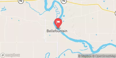
Soap Creek Watershed Site 68-76b Reservoir Report
Last Updated: February 3, 2026
Located in Monroe, Iowa, Soap Creek Watershed Site 68-76b is a flood risk reduction structure designed by the USDA NRCS and completed in 2007.
°F
°F
mph
Wind
%
Humidity
15-Day Weather Outlook
Summary
This earth dam stands at 21 feet high and spans 385 feet in length, with a storage capacity of 62 acre-feet. It serves as a vital component in managing water resources in the area, specifically along the tributary to Boyd Branch.
With a low hazard potential and not yet rated for condition assessment, Soap Creek Watershed Site 68-76b plays a crucial role in protecting the surrounding community from potential flooding events. The dam is regulated by the Iowa DNR and undergoes regular inspections, permitting, and enforcement to ensure its effectiveness in flood risk reduction. Situated in Selma, this structure highlights the importance of sustainable water management practices in mitigating the impacts of climate change on local ecosystems.
Year Completed |
2007 |
Dam Length |
385 |
Dam Height |
21 |
River Or Stream |
Trib to Boyd Branch |
Primary Dam Type |
Earth |
Surface Area |
3 |
Drainage Area |
0.27 |
Nid Storage |
62 |
Outlet Gates |
None |
Hazard Potential |
Low |
Foundations |
Soil |
Nid Height |
21 |
Seasonal Comparison
Hourly Weather Forecast
Nearby Streamflow Levels
 Chariton River Near Rathbun
|
11cfs |
 Des Moines River At Ottumwa
|
1090cfs |
 Chariton River Near Moulton
|
34cfs |
 Fox River At Bloomfield
|
7cfs |
 Cedar Creek Near Bussey
|
11cfs |
 Des Moines River Near Tracy
|
1400cfs |
Dam Data Reference
Condition Assessment
SatisfactoryNo existing or potential dam safety deficiencies are recognized. Acceptable performance is expected under all loading conditions (static, hydrologic, seismic) in accordance with the minimum applicable state or federal regulatory criteria or tolerable risk guidelines.
Fair
No existing dam safety deficiencies are recognized for normal operating conditions. Rare or extreme hydrologic and/or seismic events may result in a dam safety deficiency. Risk may be in the range to take further action. Note: Rare or extreme event is defined by the regulatory agency based on their minimum
Poor A dam safety deficiency is recognized for normal operating conditions which may realistically occur. Remedial action is necessary. POOR may also be used when uncertainties exist as to critical analysis parameters which identify a potential dam safety deficiency. Investigations and studies are necessary.
Unsatisfactory
A dam safety deficiency is recognized that requires immediate or emergency remedial action for problem resolution.
Not Rated
The dam has not been inspected, is not under state or federal jurisdiction, or has been inspected but, for whatever reason, has not been rated.
Not Available
Dams for which the condition assessment is restricted to approved government users.
Hazard Potential Classification
HighDams assigned the high hazard potential classification are those where failure or mis-operation will probably cause loss of human life.
Significant
Dams assigned the significant hazard potential classification are those dams where failure or mis-operation results in no probable loss of human life but can cause economic loss, environment damage, disruption of lifeline facilities, or impact other concerns. Significant hazard potential classification dams are often located in predominantly rural or agricultural areas but could be in areas with population and significant infrastructure.
Low
Dams assigned the low hazard potential classification are those where failure or mis-operation results in no probable loss of human life and low economic and/or environmental losses. Losses are principally limited to the owner's property.
Undetermined
Dams for which a downstream hazard potential has not been designated or is not provided.
Not Available
Dams for which the downstream hazard potential is restricted to approved government users.

 Soap Creek Watershed Site 68-76b