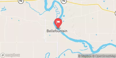
Klyn Dam Reservoir Report
Last Updated: February 3, 2026
Klyn Dam, located in Eldon, Iowa, was completed in 2016 and serves as a vital infrastructure for flood risk reduction in the region.
°F
°F
mph
Wind
%
Humidity
15-Day Weather Outlook
Summary
Designed by Kent O. Rice and French-Reneker-Associates, Inc., this privately owned earth dam stands at a height of 28 feet and has a storage capacity of 73 acre-feet. With a low hazard potential and not yet rated for condition assessment, Klyn Dam plays a crucial role in protecting the surrounding area from potential flooding events.
Managed by the Iowa Department of Natural Resources, Klyn Dam is regulated, permitted, inspected, and enforced by state authorities to ensure its continued functionality and safety. The dam's primary purpose includes flood risk reduction and grade stabilization, making it a key component of water resource management in Wapello County. With a drainage area of 0.24 square miles and a maximum discharge of 24 cubic feet per second, Klyn Dam is equipped to handle potential flood events and safeguard the local community.
As a part of the Rock Island District, Klyn Dam contributes to the overall water resource infrastructure in the area, working in conjunction with other structures to manage water flow effectively. While its condition assessment is not yet rated, ongoing inspections and regulatory oversight by the Iowa DNR ensure that the dam remains in compliance with safety standards. Climate and water resource enthusiasts can appreciate the significance of Klyn Dam in mitigating flood risks and protecting the environment in Wapello, Iowa.
Year Completed |
2016 |
Dam Height |
28 |
Primary Dam Type |
Earth |
Drainage Area |
0.24 |
Nid Storage |
73 |
Hazard Potential |
Low |
Foundations |
Soil |
Nid Height |
28 |
Seasonal Comparison
Hourly Weather Forecast
Nearby Streamflow Levels
 Des Moines River At Ottumwa
|
1090cfs |
 Chariton River Near Rathbun
|
11cfs |
 Fox River At Bloomfield
|
7cfs |
 Chariton River Near Moulton
|
34cfs |
 Cedar Creek Near Bussey
|
11cfs |
 Des Moines River Near Tracy
|
1400cfs |
Dam Data Reference
Condition Assessment
SatisfactoryNo existing or potential dam safety deficiencies are recognized. Acceptable performance is expected under all loading conditions (static, hydrologic, seismic) in accordance with the minimum applicable state or federal regulatory criteria or tolerable risk guidelines.
Fair
No existing dam safety deficiencies are recognized for normal operating conditions. Rare or extreme hydrologic and/or seismic events may result in a dam safety deficiency. Risk may be in the range to take further action. Note: Rare or extreme event is defined by the regulatory agency based on their minimum
Poor A dam safety deficiency is recognized for normal operating conditions which may realistically occur. Remedial action is necessary. POOR may also be used when uncertainties exist as to critical analysis parameters which identify a potential dam safety deficiency. Investigations and studies are necessary.
Unsatisfactory
A dam safety deficiency is recognized that requires immediate or emergency remedial action for problem resolution.
Not Rated
The dam has not been inspected, is not under state or federal jurisdiction, or has been inspected but, for whatever reason, has not been rated.
Not Available
Dams for which the condition assessment is restricted to approved government users.
Hazard Potential Classification
HighDams assigned the high hazard potential classification are those where failure or mis-operation will probably cause loss of human life.
Significant
Dams assigned the significant hazard potential classification are those dams where failure or mis-operation results in no probable loss of human life but can cause economic loss, environment damage, disruption of lifeline facilities, or impact other concerns. Significant hazard potential classification dams are often located in predominantly rural or agricultural areas but could be in areas with population and significant infrastructure.
Low
Dams assigned the low hazard potential classification are those where failure or mis-operation results in no probable loss of human life and low economic and/or environmental losses. Losses are principally limited to the owner's property.
Undetermined
Dams for which a downstream hazard potential has not been designated or is not provided.
Not Available
Dams for which the downstream hazard potential is restricted to approved government users.

 Klyn Dam