Manneter Dam Reservoir Report
Nearby: Welch Dam Steding Dam
Last Updated: February 4, 2026
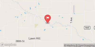
Manneter Dam, located in Gifford, Iowa, is a privately owned structure designed by the USDA NRCS for flood risk reduction along Tipton Creek.
°F
°F
mph
Wind
%
Humidity
15-Day Weather Outlook
Summary
Completed in 1997, this earth dam stands at a height of 28 feet and spans 279 feet in length, with a maximum storage capacity of 21 acre-feet. The primary purposes of the dam include flood risk reduction, grade stabilization, and recreation, ensuring the safety and enjoyment of the surrounding community.
With a low hazard potential and a moderate risk assessment rating, Manneter Dam plays a crucial role in managing water resources and mitigating potential flooding events in the region. The dam features an uncontrolled spillway with a width of 10 feet, serving as a key component for regulating water flow and preventing overflow during heavy rainfall. Despite being privately owned, the dam is subject to various state regulations, inspections, and enforcement measures to ensure its continued safety and functionality.
As a significant infrastructure project in Hardin County, Manneter Dam not only provides essential flood protection but also enhances the natural environment and recreational opportunities for local residents. Managed by the Natural Resources Conservation Service, this earth dam serves as a vital asset for water resource and climate enthusiasts, showcasing the importance of sustainable water management practices in the face of changing environmental conditions.
Year Completed |
1997 |
Dam Length |
279 |
Dam Height |
28 |
River Or Stream |
Tipton Creek |
Primary Dam Type |
Earth |
Surface Area |
2 |
Drainage Area |
0.2 |
Nid Storage |
21 |
Outlet Gates |
None |
Hazard Potential |
Low |
Foundations |
Soil |
Nid Height |
28 |
Seasonal Comparison
Hourly Weather Forecast
Nearby Streamflow Levels
Dam Data Reference
Condition Assessment
SatisfactoryNo existing or potential dam safety deficiencies are recognized. Acceptable performance is expected under all loading conditions (static, hydrologic, seismic) in accordance with the minimum applicable state or federal regulatory criteria or tolerable risk guidelines.
Fair
No existing dam safety deficiencies are recognized for normal operating conditions. Rare or extreme hydrologic and/or seismic events may result in a dam safety deficiency. Risk may be in the range to take further action. Note: Rare or extreme event is defined by the regulatory agency based on their minimum
Poor A dam safety deficiency is recognized for normal operating conditions which may realistically occur. Remedial action is necessary. POOR may also be used when uncertainties exist as to critical analysis parameters which identify a potential dam safety deficiency. Investigations and studies are necessary.
Unsatisfactory
A dam safety deficiency is recognized that requires immediate or emergency remedial action for problem resolution.
Not Rated
The dam has not been inspected, is not under state or federal jurisdiction, or has been inspected but, for whatever reason, has not been rated.
Not Available
Dams for which the condition assessment is restricted to approved government users.
Hazard Potential Classification
HighDams assigned the high hazard potential classification are those where failure or mis-operation will probably cause loss of human life.
Significant
Dams assigned the significant hazard potential classification are those dams where failure or mis-operation results in no probable loss of human life but can cause economic loss, environment damage, disruption of lifeline facilities, or impact other concerns. Significant hazard potential classification dams are often located in predominantly rural or agricultural areas but could be in areas with population and significant infrastructure.
Low
Dams assigned the low hazard potential classification are those where failure or mis-operation results in no probable loss of human life and low economic and/or environmental losses. Losses are principally limited to the owner's property.
Undetermined
Dams for which a downstream hazard potential has not been designated or is not provided.
Not Available
Dams for which the downstream hazard potential is restricted to approved government users.


 Manneter Dam