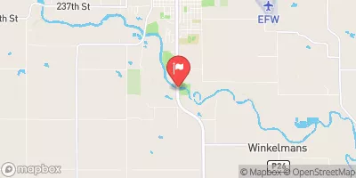
Lake Panorama At Panora Reservoir Report
Last Updated: February 2, 2026
Lake Panorama is a man-made reservoir located in Panora, Iowa.
°F
°F
mph
Wind
%
Humidity
15-Day Weather Outlook
Summary
It was created in the 1960s by damming the Middle Raccoon River. The lake has a surface area of over 1,600 acres and a maximum depth of 50 feet. It is primarily used for recreation, including boating, fishing, and swimming. The lake is also a popular destination for golfers, with two golf courses located on its shores. The hydrology of the lake is supported by a variety of surface water sources, including runoff from surrounding land, as well as snowmelt and precipitation. Agriculture is a significant land use in the area, with corn and soybeans being the primary crops grown in the region. The lake provides important habitat for a variety of aquatic species, including walleye, largemouth bass, and northern pike.
Reservoir Details
| Gage Height, Ft 24hr Change | -0.26% |
| Percent of Normal | 100% |
| Minimum |
40.25 ft
2025-10-14 |
| Maximum |
46.56 ft
2013-06-15 |
| Average | 45 ft |
| Dam_Height | 70 |
| Drainage_Area | 440 |
| Year_Completed | 1969 |
| Nid_Storage | 60200 |
| River_Or_Stream | MIDDLE RACCOON RIVER |
| Foundations | Rock, Soil |
| Surface_Area | 1260 |
| Hazard_Potential | Significant |
| Dam_Length | 815 |
| Primary_Dam_Type | Earth |
| Nid_Height | 70 |
Seasonal Comparison
Gage Height, Ft Levels
Hourly Weather Forecast
Nearby Streamflow Levels
 Middle Raccoon River At Panora
|
92cfs |
 Middle Raccoon River Near Bayard
|
121cfs |
 South Raccoon River At Redfield
|
268cfs |
 North Raccoon River Near Jefferson
|
530cfs |
 Raccoon River At Van Meter
|
1640cfs |
 Raccoon River Near West Des Moines
|
1300cfs |
Dam Data Reference
Condition Assessment
SatisfactoryNo existing or potential dam safety deficiencies are recognized. Acceptable performance is expected under all loading conditions (static, hydrologic, seismic) in accordance with the minimum applicable state or federal regulatory criteria or tolerable risk guidelines.
Fair
No existing dam safety deficiencies are recognized for normal operating conditions. Rare or extreme hydrologic and/or seismic events may result in a dam safety deficiency. Risk may be in the range to take further action. Note: Rare or extreme event is defined by the regulatory agency based on their minimum
Poor A dam safety deficiency is recognized for normal operating conditions which may realistically occur. Remedial action is necessary. POOR may also be used when uncertainties exist as to critical analysis parameters which identify a potential dam safety deficiency. Investigations and studies are necessary.
Unsatisfactory
A dam safety deficiency is recognized that requires immediate or emergency remedial action for problem resolution.
Not Rated
The dam has not been inspected, is not under state or federal jurisdiction, or has been inspected but, for whatever reason, has not been rated.
Not Available
Dams for which the condition assessment is restricted to approved government users.
Hazard Potential Classification
HighDams assigned the high hazard potential classification are those where failure or mis-operation will probably cause loss of human life.
Significant
Dams assigned the significant hazard potential classification are those dams where failure or mis-operation results in no probable loss of human life but can cause economic loss, environment damage, disruption of lifeline facilities, or impact other concerns. Significant hazard potential classification dams are often located in predominantly rural or agricultural areas but could be in areas with population and significant infrastructure.
Low
Dams assigned the low hazard potential classification are those where failure or mis-operation results in no probable loss of human life and low economic and/or environmental losses. Losses are principally limited to the owner's property.
Undetermined
Dams for which a downstream hazard potential has not been designated or is not provided.
Not Available
Dams for which the downstream hazard potential is restricted to approved government users.

 Lake Panorama Dam
 Lake Panorama At Panora