Dd No 2-18a Reservoir Report
Nearby: Dd No 2-35 (Lewis Dam) Dd No 1-23c
Last Updated: February 3, 2026
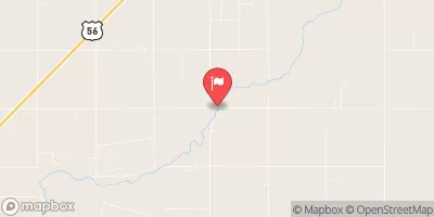
Dd No 2-18a, also known as Pawnee Watershed Dam 2-18a, is a local government-owned structure located in Sanford, Kansas, within the Pawnee River watershed.
°F
°F
mph
Wind
%
Humidity
15-Day Weather Outlook
Summary
Built in 1976 by the USDA NRCS, this earth dam stands at a height of 23 feet with a hydraulic height of 26 feet and a structural height of 27 feet. The dam's primary purpose is flood risk reduction, serving to protect the surrounding area from potential water-related disasters.
With a storage capacity of 1,483 acre-feet and a normal storage of 97 acre-feet, Dd No 2-18a covers a surface area of 26.6 acres and drains an area of 4.96 square miles. The dam's spillway, of uncontrolled type, boasts a width of 100 feet and a maximum discharge capacity of 2,508 cubic feet per second. Despite being classified as having a low hazard potential, Dd No 2-18a is in fair condition as of its last inspection in April 2014, and is under the regulatory jurisdiction of the Kansas Department of Agriculture.
Overall, Dd No 2-18a plays a crucial role in managing flood risks within the Pawnee River watershed, offering protection to the local community against potential water-related emergencies. The dam's design and construction by the Natural Resources Conservation Service reflect a commitment to sustainable water resource management, while its state-regulated status ensures ongoing monitoring and enforcement to maintain its structural integrity and functionality for years to come.
Year Completed |
1976 |
Dam Length |
1785 |
Dam Height |
23 |
River Or Stream |
PAWNEE RIVER-TR |
Primary Dam Type |
Earth |
Surface Area |
26.6 |
Hydraulic Height |
26 |
Drainage Area |
4.96 |
Nid Storage |
1483 |
Structural Height |
27 |
Outlet Gates |
None |
Hazard Potential |
Low |
Foundations |
Unlisted/Unknown |
Nid Height |
27 |
Seasonal Comparison
Hourly Weather Forecast
Nearby Streamflow Levels
 Pawnee R Nr Burdett
|
0cfs |
 Pawnee R At Rozel
|
4cfs |
 Walnut C At Nekoma
|
3cfs |
 Smoky Hill R Nr Schoenchen
|
2cfs |
 Smoky Hill R Bl Schoenchen
|
2cfs |
 Arkansas R Nr Larned
|
10cfs |
Dam Data Reference
Condition Assessment
SatisfactoryNo existing or potential dam safety deficiencies are recognized. Acceptable performance is expected under all loading conditions (static, hydrologic, seismic) in accordance with the minimum applicable state or federal regulatory criteria or tolerable risk guidelines.
Fair
No existing dam safety deficiencies are recognized for normal operating conditions. Rare or extreme hydrologic and/or seismic events may result in a dam safety deficiency. Risk may be in the range to take further action. Note: Rare or extreme event is defined by the regulatory agency based on their minimum
Poor A dam safety deficiency is recognized for normal operating conditions which may realistically occur. Remedial action is necessary. POOR may also be used when uncertainties exist as to critical analysis parameters which identify a potential dam safety deficiency. Investigations and studies are necessary.
Unsatisfactory
A dam safety deficiency is recognized that requires immediate or emergency remedial action for problem resolution.
Not Rated
The dam has not been inspected, is not under state or federal jurisdiction, or has been inspected but, for whatever reason, has not been rated.
Not Available
Dams for which the condition assessment is restricted to approved government users.
Hazard Potential Classification
HighDams assigned the high hazard potential classification are those where failure or mis-operation will probably cause loss of human life.
Significant
Dams assigned the significant hazard potential classification are those dams where failure or mis-operation results in no probable loss of human life but can cause economic loss, environment damage, disruption of lifeline facilities, or impact other concerns. Significant hazard potential classification dams are often located in predominantly rural or agricultural areas but could be in areas with population and significant infrastructure.
Low
Dams assigned the low hazard potential classification are those where failure or mis-operation results in no probable loss of human life and low economic and/or environmental losses. Losses are principally limited to the owner's property.
Undetermined
Dams for which a downstream hazard potential has not been designated or is not provided.
Not Available
Dams for which the downstream hazard potential is restricted to approved government users.

 Dd No 2-18a