Frd No 7 Reservoir Report
Nearby: Frd No 12 Lake Herington
Last Updated: February 1, 2026
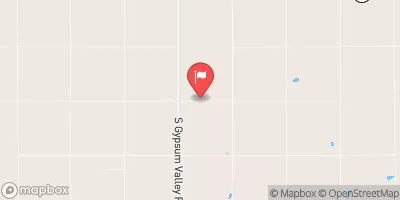
Frd No 7, also known as Lyons Creek Watershed Dam 7, is a crucial water resource infrastructure located in Dickinson County, Kansas.
°F
°F
mph
Wind
%
Humidity
15-Day Weather Outlook
Summary
Built in 1974 by the USDA NRCS, this earth dam stands at a height of 35 feet and serves primarily for flood risk reduction in the area. With a storage capacity of 565.87 acre-feet and a drainage area of 1.1 square miles, the dam plays a significant role in managing water flow and protecting the surrounding community from potential flooding events.
Managed by the local government and regulated by the Kansas Department of Agriculture, Frd No 7 is inspected every five years to ensure its structural integrity and functionality. The dam has been assessed to be in fair condition with a significant hazard potential, highlighting the importance of regular monitoring and maintenance. Despite its age, Frd No 7 continues to serve its purpose effectively, providing essential flood protection for the residents of Lyona and the surrounding areas.
With a spillway width of 40 feet and uncontrolled spillway type, Frd No 7 is equipped to manage excess water flow during heavy rainfall events. The dam's location along Lyon Creek-TR and its critical role in flood risk reduction underscore the importance of maintaining this infrastructure to safeguard the community and preserve the local ecosystem. As water resource and climate enthusiasts, it is vital to recognize the significance of structures like Frd No 7 in ensuring water security and resilience in the face of changing climate patterns.
Year Completed |
1974 |
Dam Length |
1400 |
Dam Height |
35 |
River Or Stream |
LYON CREEK-TR |
Primary Dam Type |
Earth |
Surface Area |
15.18 |
Hydraulic Height |
26 |
Drainage Area |
1.1 |
Nid Storage |
565.87 |
Structural Height |
35 |
Outlet Gates |
None |
Hazard Potential |
Significant |
Foundations |
Unlisted/Unknown |
Nid Height |
35 |
Seasonal Comparison
Hourly Weather Forecast
Nearby Streamflow Levels
 Smoky Hill R At Enterprise
|
377cfs |
 Lyon C Nr Junction City
|
17cfs |
 N Cottonwood R Bl Marion Lk
|
2cfs |
 Chapman C Nr Chapman
|
16cfs |
 Gypsum C Nr Gypsum
|
15cfs |
 Republican R Bl Milford Dam
|
417cfs |
Dam Data Reference
Condition Assessment
SatisfactoryNo existing or potential dam safety deficiencies are recognized. Acceptable performance is expected under all loading conditions (static, hydrologic, seismic) in accordance with the minimum applicable state or federal regulatory criteria or tolerable risk guidelines.
Fair
No existing dam safety deficiencies are recognized for normal operating conditions. Rare or extreme hydrologic and/or seismic events may result in a dam safety deficiency. Risk may be in the range to take further action. Note: Rare or extreme event is defined by the regulatory agency based on their minimum
Poor A dam safety deficiency is recognized for normal operating conditions which may realistically occur. Remedial action is necessary. POOR may also be used when uncertainties exist as to critical analysis parameters which identify a potential dam safety deficiency. Investigations and studies are necessary.
Unsatisfactory
A dam safety deficiency is recognized that requires immediate or emergency remedial action for problem resolution.
Not Rated
The dam has not been inspected, is not under state or federal jurisdiction, or has been inspected but, for whatever reason, has not been rated.
Not Available
Dams for which the condition assessment is restricted to approved government users.
Hazard Potential Classification
HighDams assigned the high hazard potential classification are those where failure or mis-operation will probably cause loss of human life.
Significant
Dams assigned the significant hazard potential classification are those dams where failure or mis-operation results in no probable loss of human life but can cause economic loss, environment damage, disruption of lifeline facilities, or impact other concerns. Significant hazard potential classification dams are often located in predominantly rural or agricultural areas but could be in areas with population and significant infrastructure.
Low
Dams assigned the low hazard potential classification are those where failure or mis-operation results in no probable loss of human life and low economic and/or environmental losses. Losses are principally limited to the owner's property.
Undetermined
Dams for which a downstream hazard potential has not been designated or is not provided.
Not Available
Dams for which the downstream hazard potential is restricted to approved government users.

 Frd No 7