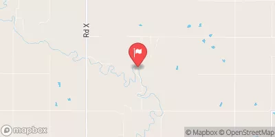
Frd No 2-4 Reservoir Report
Nearby: Frd No 3-1 Frd No 2-3
Last Updated: February 22, 2026
Frd No 2-4, also known as Upper Verdigris WS Dam 2 4, is a local government-owned structure located in Lyon, Kansas, specifically in the city of Madison.
Summary
Completed in 1963, this earth dam stands at a height of 43 feet and has a maximum storage capacity of 2796.92 acre-feet. Its primary purpose is flood risk reduction, with a low hazard potential and a moderate risk assessment rating.
Managed by the USDA NRCS, Frd No 2-4 is regulated by the Kansas Department of Agriculture and is subject to state permitting, inspection, and enforcement. The dam spans a length of 1800 feet and is situated on Shaw Creek, with a drainage area of 5.79 square miles. Despite its uncontrolled spillway type, the structure has not been rated for its condition assessment and lacks an emergency action plan. With a risk management measure of moderate (3), Frd No 2-4 serves as a vital component in the local water resource infrastructure for flood risk mitigation.
°F
°F
mph
Wind
%
Humidity
15-Day Weather Outlook
Year Completed |
1963 |
Dam Length |
1800 |
Dam Height |
43 |
River Or Stream |
SHAW CREEK |
Primary Dam Type |
Earth |
Surface Area |
25.14 |
Hydraulic Height |
40 |
Drainage Area |
5.79 |
Nid Storage |
2796.92 |
Structural Height |
43 |
Outlet Gates |
None |
Hazard Potential |
Low |
Foundations |
Unlisted/Unknown |
Nid Height |
43 |
Seasonal Comparison
5-Day Hourly Forecast Detail
Nearby Streamflow Levels
 Cottonwood R Nr Plymouth
|
934cfs |
 Neosho R Nr Americus
|
216cfs |
 Cedar C Nr Cedar Point
|
64cfs |
 Verdigris R Nr Virgil
|
270cfs |
 Cottonwood R Nr Florence
|
251cfs |
 Marais Des Cygnes R Nr Reading
|
50cfs |
Dam Data Reference
Condition Assessment
SatisfactoryNo existing or potential dam safety deficiencies are recognized. Acceptable performance is expected under all loading conditions (static, hydrologic, seismic) in accordance with the minimum applicable state or federal regulatory criteria or tolerable risk guidelines.
Fair
No existing dam safety deficiencies are recognized for normal operating conditions. Rare or extreme hydrologic and/or seismic events may result in a dam safety deficiency. Risk may be in the range to take further action. Note: Rare or extreme event is defined by the regulatory agency based on their minimum
Poor A dam safety deficiency is recognized for normal operating conditions which may realistically occur. Remedial action is necessary. POOR may also be used when uncertainties exist as to critical analysis parameters which identify a potential dam safety deficiency. Investigations and studies are necessary.
Unsatisfactory
A dam safety deficiency is recognized that requires immediate or emergency remedial action for problem resolution.
Not Rated
The dam has not been inspected, is not under state or federal jurisdiction, or has been inspected but, for whatever reason, has not been rated.
Not Available
Dams for which the condition assessment is restricted to approved government users.
Hazard Potential Classification
HighDams assigned the high hazard potential classification are those where failure or mis-operation will probably cause loss of human life.
Significant
Dams assigned the significant hazard potential classification are those dams where failure or mis-operation results in no probable loss of human life but can cause economic loss, environment damage, disruption of lifeline facilities, or impact other concerns. Significant hazard potential classification dams are often located in predominantly rural or agricultural areas but could be in areas with population and significant infrastructure.
Low
Dams assigned the low hazard potential classification are those where failure or mis-operation results in no probable loss of human life and low economic and/or environmental losses. Losses are principally limited to the owner's property.
Undetermined
Dams for which a downstream hazard potential has not been designated or is not provided.
Not Available
Dams for which the downstream hazard potential is restricted to approved government users.

 Frd No 2-4