Summary
Built in 1983 by the USDA NRCS, this earth dam stands at a height of 40 feet and has a length of 1470 feet. Its primary purpose is flood risk reduction, with a storage capacity of 2013.2 acre-feet and a drainage area of 5.67 square miles.
With a significant hazard potential and moderate risk assessment rating, Frd No 18 plays a crucial role in managing water resources in the area. The dam has a spillway width of 160 feet and a maximum discharge capacity of 3344.9 cubic feet per second. Despite not being rated for its condition, the dam undergoes inspections every 5 years to ensure its structural integrity and effectiveness in flood control.
As a key component in the SALT CREEK-TR watershed, Frd No 18 serves as a critical infrastructure for the community, providing protection against flooding and safeguarding the surrounding environment. Its location in Mitchell County, Kansas, highlights its importance in water resource management and climate resilience efforts in the region.
°F
°F
mph
Wind
%
Humidity
15-Day Weather Outlook
Year Completed |
1983 |
Dam Length |
1470 |
Dam Height |
40 |
River Or Stream |
SALT CREEK-TR |
Primary Dam Type |
Earth |
Surface Area |
32.36 |
Drainage Area |
5.67 |
Nid Storage |
2013.2 |
Outlet Gates |
None |
Hazard Potential |
Significant |
Foundations |
Unlisted/Unknown |
Nid Height |
40 |
Seasonal Comparison
5-Day Hourly Forecast Detail
Nearby Streamflow Levels
 Solomon R At Beloit
|
16cfs |
 Solomon R Nr Glen Elder
|
16cfs |
 Salt C Nr Ada
|
25cfs |
 Saline R At Tescott
|
23cfs |
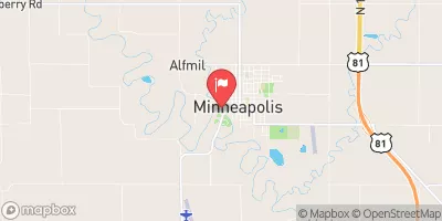 Solomon R Nr Minneapolis
|
40cfs |
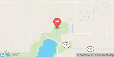 Saline R At Wilson Dam
|
7cfs |
Dam Data Reference
Condition Assessment
SatisfactoryNo existing or potential dam safety deficiencies are recognized. Acceptable performance is expected under all loading conditions (static, hydrologic, seismic) in accordance with the minimum applicable state or federal regulatory criteria or tolerable risk guidelines.
Fair
No existing dam safety deficiencies are recognized for normal operating conditions. Rare or extreme hydrologic and/or seismic events may result in a dam safety deficiency. Risk may be in the range to take further action. Note: Rare or extreme event is defined by the regulatory agency based on their minimum
Poor A dam safety deficiency is recognized for normal operating conditions which may realistically occur. Remedial action is necessary. POOR may also be used when uncertainties exist as to critical analysis parameters which identify a potential dam safety deficiency. Investigations and studies are necessary.
Unsatisfactory
A dam safety deficiency is recognized that requires immediate or emergency remedial action for problem resolution.
Not Rated
The dam has not been inspected, is not under state or federal jurisdiction, or has been inspected but, for whatever reason, has not been rated.
Not Available
Dams for which the condition assessment is restricted to approved government users.
Hazard Potential Classification
HighDams assigned the high hazard potential classification are those where failure or mis-operation will probably cause loss of human life.
Significant
Dams assigned the significant hazard potential classification are those dams where failure or mis-operation results in no probable loss of human life but can cause economic loss, environment damage, disruption of lifeline facilities, or impact other concerns. Significant hazard potential classification dams are often located in predominantly rural or agricultural areas but could be in areas with population and significant infrastructure.
Low
Dams assigned the low hazard potential classification are those where failure or mis-operation results in no probable loss of human life and low economic and/or environmental losses. Losses are principally limited to the owner's property.
Undetermined
Dams for which a downstream hazard potential has not been designated or is not provided.
Not Available
Dams for which the downstream hazard potential is restricted to approved government users.

 Frd No 18