Dd No C-15 Reservoir Report
Nearby: Dd No C-16 Dd No C-18
Last Updated: January 2, 2026
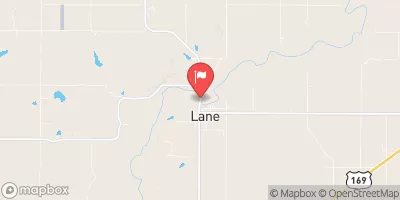
Dd No C-15 is a local government-owned earthen dam located in Lane, Anderson County, Kansas.
°F
°F
mph
Wind
%
Humidity
Summary
Completed in 1980 for the primary purpose of flood risk reduction, this structure stands at a height of 35 feet and spans a length of 2200 feet. With a maximum storage capacity of 1678 acre-feet and a normal storage capacity of 410 acre-feet, the dam serves to protect the surrounding area from the potential impacts of flooding.
Managed by the Kansas Department of Agriculture, Dd No C-15 is regulated, permitted, inspected, and enforced by state agencies to ensure its continued safety and functionality. Although the dam is classified as having a low hazard potential, a moderate risk assessment score of 3 indicates a need for ongoing monitoring and risk management measures. With a drainage area of 2.89 square miles and a spillway width of 40 feet, the dam has the capacity to handle a maximum discharge of 1185 cubic feet per second.
For water resource and climate enthusiasts, Dd No C-15 presents an intriguing case study in dam infrastructure and flood risk reduction. Situated along Elm Creek in the Tulsa District, this earth dam plays a crucial role in mitigating potential flood hazards in the region. As efforts continue to assess and manage the risks associated with this structure, it serves as a reminder of the importance of maintaining and monitoring our water management systems for the benefit of both local communities and the environment.
Year Completed |
1980 |
Dam Length |
2200 |
Dam Height |
35 |
River Or Stream |
ELM CREEK-TR |
Primary Dam Type |
Earth |
Surface Area |
56 |
Drainage Area |
2.89 |
Nid Storage |
1678 |
Outlet Gates |
None |
Hazard Potential |
Low |
Foundations |
Unlisted/Unknown |
Nid Height |
35 |
Seasonal Comparison
Weather Forecast
Nearby Streamflow Levels
 Pottawatomie C Nr Scipio
|
15cfs |
 Neosho R At Burlington
|
819cfs |
 Marais Des Cygnes R At Melvern
|
107cfs |
 Marais Des Cygnes R Nr Pomona
|
51cfs |
 Salt C At Lyndon
|
5cfs |
 Pottawatomie C At Lane
|
5cfs |
Dam Data Reference
Condition Assessment
SatisfactoryNo existing or potential dam safety deficiencies are recognized. Acceptable performance is expected under all loading conditions (static, hydrologic, seismic) in accordance with the minimum applicable state or federal regulatory criteria or tolerable risk guidelines.
Fair
No existing dam safety deficiencies are recognized for normal operating conditions. Rare or extreme hydrologic and/or seismic events may result in a dam safety deficiency. Risk may be in the range to take further action. Note: Rare or extreme event is defined by the regulatory agency based on their minimum
Poor A dam safety deficiency is recognized for normal operating conditions which may realistically occur. Remedial action is necessary. POOR may also be used when uncertainties exist as to critical analysis parameters which identify a potential dam safety deficiency. Investigations and studies are necessary.
Unsatisfactory
A dam safety deficiency is recognized that requires immediate or emergency remedial action for problem resolution.
Not Rated
The dam has not been inspected, is not under state or federal jurisdiction, or has been inspected but, for whatever reason, has not been rated.
Not Available
Dams for which the condition assessment is restricted to approved government users.
Hazard Potential Classification
HighDams assigned the high hazard potential classification are those where failure or mis-operation will probably cause loss of human life.
Significant
Dams assigned the significant hazard potential classification are those dams where failure or mis-operation results in no probable loss of human life but can cause economic loss, environment damage, disruption of lifeline facilities, or impact other concerns. Significant hazard potential classification dams are often located in predominantly rural or agricultural areas but could be in areas with population and significant infrastructure.
Low
Dams assigned the low hazard potential classification are those where failure or mis-operation results in no probable loss of human life and low economic and/or environmental losses. Losses are principally limited to the owner's property.
Undetermined
Dams for which a downstream hazard potential has not been designated or is not provided.
Not Available
Dams for which the downstream hazard potential is restricted to approved government users.

 Dd No C-15