Dd No C-10 Reservoir Report
Nearby: Debrabander Pond Dd No C-15
Last Updated: December 29, 2025
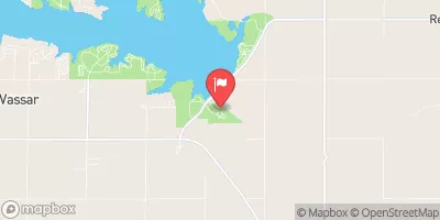
Dd No C-10 is a local government-owned earth dam located on Elm Creek in Coffey, Kansas.
°F
°F
mph
Wind
%
Humidity
Summary
Completed in 1996, this dam serves the primary purpose of flood risk reduction and has a height of 27 feet and a length of 650 feet. With a storage capacity of 187 acre-feet and a normal storage level of 28.65 feet, Dd No C-10 covers a surface area of 5.05 acres and drains a 0.66 square mile watershed.
Despite being classified as having a low hazard potential and not yet rated for condition assessment, Dd No C-10 presents a moderate risk level. With an uncontrolled spillway width of 40 feet and no outlet gates, this dam has not been inspected since its completion in 1996. While it is not regulated by the state and lacks a formal emergency action plan, Dd No C-10 stands as an essential structure for flood risk mitigation in the area, showcasing the importance of proper maintenance and monitoring for water resource and climate enthusiasts to ensure its continued effectiveness.
Year Completed |
1996 |
Dam Length |
650 |
Dam Height |
27 |
River Or Stream |
ELM CREEK |
Primary Dam Type |
Earth |
Surface Area |
5.05 |
Drainage Area |
0.66 |
Nid Storage |
187 |
Outlet Gates |
None |
Hazard Potential |
Low |
Foundations |
Unlisted/Unknown |
Nid Height |
27 |
Seasonal Comparison
Weather Forecast
Nearby Streamflow Levels
 Marais Des Cygnes R At Melvern
|
106cfs |
 Marais Des Cygnes R Nr Pomona
|
51cfs |
 Neosho R At Burlington
|
461cfs |
 Pottawatomie C Nr Scipio
|
15cfs |
 Salt C At Lyndon
|
5cfs |
 Hundred And Ten Mile C Nr Quenemo
|
15cfs |
Dam Data Reference
Condition Assessment
SatisfactoryNo existing or potential dam safety deficiencies are recognized. Acceptable performance is expected under all loading conditions (static, hydrologic, seismic) in accordance with the minimum applicable state or federal regulatory criteria or tolerable risk guidelines.
Fair
No existing dam safety deficiencies are recognized for normal operating conditions. Rare or extreme hydrologic and/or seismic events may result in a dam safety deficiency. Risk may be in the range to take further action. Note: Rare or extreme event is defined by the regulatory agency based on their minimum
Poor A dam safety deficiency is recognized for normal operating conditions which may realistically occur. Remedial action is necessary. POOR may also be used when uncertainties exist as to critical analysis parameters which identify a potential dam safety deficiency. Investigations and studies are necessary.
Unsatisfactory
A dam safety deficiency is recognized that requires immediate or emergency remedial action for problem resolution.
Not Rated
The dam has not been inspected, is not under state or federal jurisdiction, or has been inspected but, for whatever reason, has not been rated.
Not Available
Dams for which the condition assessment is restricted to approved government users.
Hazard Potential Classification
HighDams assigned the high hazard potential classification are those where failure or mis-operation will probably cause loss of human life.
Significant
Dams assigned the significant hazard potential classification are those dams where failure or mis-operation results in no probable loss of human life but can cause economic loss, environment damage, disruption of lifeline facilities, or impact other concerns. Significant hazard potential classification dams are often located in predominantly rural or agricultural areas but could be in areas with population and significant infrastructure.
Low
Dams assigned the low hazard potential classification are those where failure or mis-operation results in no probable loss of human life and low economic and/or environmental losses. Losses are principally limited to the owner's property.
Undetermined
Dams for which a downstream hazard potential has not been designated or is not provided.
Not Available
Dams for which the downstream hazard potential is restricted to approved government users.

 Dd No C-10