Frd No 7 Reservoir Report
Nearby: 8 - North Sector Frd No 9
Last Updated: February 21, 2026
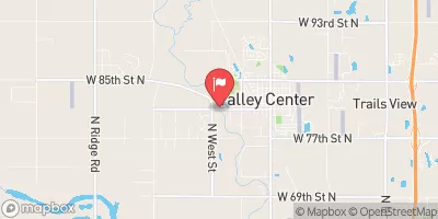
Frd No 7, located in Butler County, Kansas, is a vital flood risk reduction structure designed by the USDA NRCS and completed in 1981.
Summary
This earth dam stands at a height of 27.3 feet and spans 2300 feet, providing essential protection to the surrounding area from potential flooding events. The dam has a normal storage capacity of 20 acre-feet and a maximum storage capacity of 684 acre-feet, serving a drainage area of 1.19 square miles along the Walnut River.
Despite its fair condition assessment and high hazard potential, Frd No 7 is regularly inspected by the Kansas Department of Agriculture to ensure its reliability and effectiveness. The dam's spillway, with a width of 40 feet, helps manage high discharge levels up to 950 cubic feet per second during peak flow events. With a moderate risk assessment rating and a designated emergency action plan, Frd No 7 remains prepared to address any potential risks or emergencies that may arise, reflecting a commitment to safeguarding the local community and environment from the impacts of flooding.
°F
°F
mph
Wind
%
Humidity
15-Day Weather Outlook
Year Completed |
1981 |
Dam Length |
2300 |
Dam Height |
27.3 |
River Or Stream |
WALNUT RIVER-TR |
Primary Dam Type |
Earth |
Surface Area |
7 |
Drainage Area |
1.19 |
Nid Storage |
684 |
Outlet Gates |
None |
Hazard Potential |
High |
Foundations |
Unlisted/Unknown |
Nid Height |
27 |
Seasonal Comparison
5-Day Hourly Forecast Detail
Nearby Streamflow Levels
 Whitewater R At Towanda
|
125cfs |
 Cedar C Nr Cedar Point
|
64cfs |
 Cottonwood R Nr Florence
|
251cfs |
 L Arkansas R At Valley Center
|
95cfs |
 Arkansas R Nr Maize
|
203cfs |
 Floodway At L Arkansas R At Valley Center
|
0cfs |
Dam Data Reference
Condition Assessment
SatisfactoryNo existing or potential dam safety deficiencies are recognized. Acceptable performance is expected under all loading conditions (static, hydrologic, seismic) in accordance with the minimum applicable state or federal regulatory criteria or tolerable risk guidelines.
Fair
No existing dam safety deficiencies are recognized for normal operating conditions. Rare or extreme hydrologic and/or seismic events may result in a dam safety deficiency. Risk may be in the range to take further action. Note: Rare or extreme event is defined by the regulatory agency based on their minimum
Poor A dam safety deficiency is recognized for normal operating conditions which may realistically occur. Remedial action is necessary. POOR may also be used when uncertainties exist as to critical analysis parameters which identify a potential dam safety deficiency. Investigations and studies are necessary.
Unsatisfactory
A dam safety deficiency is recognized that requires immediate or emergency remedial action for problem resolution.
Not Rated
The dam has not been inspected, is not under state or federal jurisdiction, or has been inspected but, for whatever reason, has not been rated.
Not Available
Dams for which the condition assessment is restricted to approved government users.
Hazard Potential Classification
HighDams assigned the high hazard potential classification are those where failure or mis-operation will probably cause loss of human life.
Significant
Dams assigned the significant hazard potential classification are those dams where failure or mis-operation results in no probable loss of human life but can cause economic loss, environment damage, disruption of lifeline facilities, or impact other concerns. Significant hazard potential classification dams are often located in predominantly rural or agricultural areas but could be in areas with population and significant infrastructure.
Low
Dams assigned the low hazard potential classification are those where failure or mis-operation results in no probable loss of human life and low economic and/or environmental losses. Losses are principally limited to the owner's property.
Undetermined
Dams for which a downstream hazard potential has not been designated or is not provided.
Not Available
Dams for which the downstream hazard potential is restricted to approved government users.

 Frd No 7