Gs Dd No D-40 Reservoir Report
Nearby: Gs Dd No D-39 Gs Dd No D-73
Last Updated: February 23, 2026
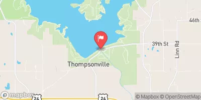
Gs Dd No D-40 is a vital local government-owned structure in Kansas, specifically located in Jackson County.
Summary
This earth-type dam, constructed in 1998 by the Delaware WJD No. 10 designer, serves the primary purpose of debris control along the South Cedar Creek-TR. With a height of 38.4 feet and a storage capacity of 661.5 acre-feet, the dam plays a crucial role in managing water resources in the area.
Despite its low hazard potential, Gs Dd No D-40 is regulated, permitted, inspected, and enforced by the Kansas Department of Agriculture, ensuring its safety and functionality. The dam has a moderate risk assessment rating of 3 and a normal storage capacity of 134.7 acre-feet. With a spillway width of 60 feet and a maximum discharge of 1496 cubic feet per second, the structure is designed to handle potential overflow and prevent flooding in the surrounding areas.
Overall, Gs Dd No D-40 is a key component of water resource management in Kansas, contributing to debris control and flood prevention efforts. Its strategic location and design features make it an essential asset for local water infrastructure, supported by state-regulated inspections and enforcement measures to ensure its continued reliability and safety.
°F
°F
mph
Wind
%
Humidity
15-Day Weather Outlook
Year Completed |
1998 |
Dam Length |
50 |
Dam Height |
38.4 |
River Or Stream |
SOUTH CEDAR CREEK-TR |
Primary Dam Type |
Earth |
Surface Area |
17.2 |
Drainage Area |
1.92 |
Nid Storage |
661.5 |
Outlet Gates |
None |
Hazard Potential |
Low |
Foundations |
Unlisted/Unknown |
Nid Height |
38 |
Seasonal Comparison
5-Day Hourly Forecast Detail
Nearby Streamflow Levels
 Delaware R Nr Muscotah
|
30cfs |
 Soldier C Nr Delia
|
4cfs |
 Soldier C Nr Topeka
|
9cfs |
 Kansas R At Topeka
|
1120cfs |
 Delaware R Bl Perry Dam
|
433cfs |
 Kansas R At Lecompton
|
1870cfs |
Dam Data Reference
Condition Assessment
SatisfactoryNo existing or potential dam safety deficiencies are recognized. Acceptable performance is expected under all loading conditions (static, hydrologic, seismic) in accordance with the minimum applicable state or federal regulatory criteria or tolerable risk guidelines.
Fair
No existing dam safety deficiencies are recognized for normal operating conditions. Rare or extreme hydrologic and/or seismic events may result in a dam safety deficiency. Risk may be in the range to take further action. Note: Rare or extreme event is defined by the regulatory agency based on their minimum
Poor A dam safety deficiency is recognized for normal operating conditions which may realistically occur. Remedial action is necessary. POOR may also be used when uncertainties exist as to critical analysis parameters which identify a potential dam safety deficiency. Investigations and studies are necessary.
Unsatisfactory
A dam safety deficiency is recognized that requires immediate or emergency remedial action for problem resolution.
Not Rated
The dam has not been inspected, is not under state or federal jurisdiction, or has been inspected but, for whatever reason, has not been rated.
Not Available
Dams for which the condition assessment is restricted to approved government users.
Hazard Potential Classification
HighDams assigned the high hazard potential classification are those where failure or mis-operation will probably cause loss of human life.
Significant
Dams assigned the significant hazard potential classification are those dams where failure or mis-operation results in no probable loss of human life but can cause economic loss, environment damage, disruption of lifeline facilities, or impact other concerns. Significant hazard potential classification dams are often located in predominantly rural or agricultural areas but could be in areas with population and significant infrastructure.
Low
Dams assigned the low hazard potential classification are those where failure or mis-operation results in no probable loss of human life and low economic and/or environmental losses. Losses are principally limited to the owner's property.
Undetermined
Dams for which a downstream hazard potential has not been designated or is not provided.
Not Available
Dams for which the downstream hazard potential is restricted to approved government users.

 Gs Dd No D-40