Gs Dd No D-39 Reservoir Report
Nearby: Gs Dd No D-40 Gs Dd No D-73
Last Updated: February 23, 2026
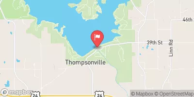
Gs Dd No D-39 is a local government-owned earth dam located in Jackson, Kansas, along the South Cedar Creek.
Summary
Designed by Greg Maxwell, this dam serves as a crucial flood risk reduction structure in the area. With a height of 39.4 feet and a storage capacity of 430 acre-feet, it plays a significant role in managing water flow and protecting the surrounding communities from potential flooding events.
Managed by the Kansas Department of Agriculture, Gs Dd No D-39 has a low hazard potential and a moderate risk assessment rating. While the dam has not been rated for its condition, it is regularly inspected, permitted, and enforced by the state regulatory agency. The presence of an uncontrolled spillway with a width of 55 feet ensures effective water release during high flow events, further enhancing the dam's flood risk reduction capabilities.
Despite its simple structure and design, Gs Dd No D-39 remains a vital component of the local water resource management system. With its strategic location along the South Cedar Creek and its ability to store and release water efficiently, this dam exemplifies the importance of proactive flood risk reduction measures in mitigating the impacts of extreme weather events and ensuring the safety and well-being of the community.
°F
°F
mph
Wind
%
Humidity
15-Day Weather Outlook
Dam Length |
665 |
Dam Height |
39.4 |
River Or Stream |
SOUTH CEDAR CREEK |
Primary Dam Type |
Earth |
Surface Area |
11.8 |
Drainage Area |
1.26 |
Nid Storage |
430 |
Outlet Gates |
None |
Hazard Potential |
Low |
Foundations |
Unlisted/Unknown |
Nid Height |
39 |
Seasonal Comparison
5-Day Hourly Forecast Detail
Nearby Streamflow Levels
 Delaware R Nr Muscotah
|
30cfs |
 Soldier C Nr Delia
|
4cfs |
 Soldier C Nr Topeka
|
9cfs |
 Kansas R At Topeka
|
1120cfs |
 Delaware R Bl Perry Dam
|
433cfs |
 Kansas R At Lecompton
|
1870cfs |
Dam Data Reference
Condition Assessment
SatisfactoryNo existing or potential dam safety deficiencies are recognized. Acceptable performance is expected under all loading conditions (static, hydrologic, seismic) in accordance with the minimum applicable state or federal regulatory criteria or tolerable risk guidelines.
Fair
No existing dam safety deficiencies are recognized for normal operating conditions. Rare or extreme hydrologic and/or seismic events may result in a dam safety deficiency. Risk may be in the range to take further action. Note: Rare or extreme event is defined by the regulatory agency based on their minimum
Poor A dam safety deficiency is recognized for normal operating conditions which may realistically occur. Remedial action is necessary. POOR may also be used when uncertainties exist as to critical analysis parameters which identify a potential dam safety deficiency. Investigations and studies are necessary.
Unsatisfactory
A dam safety deficiency is recognized that requires immediate or emergency remedial action for problem resolution.
Not Rated
The dam has not been inspected, is not under state or federal jurisdiction, or has been inspected but, for whatever reason, has not been rated.
Not Available
Dams for which the condition assessment is restricted to approved government users.
Hazard Potential Classification
HighDams assigned the high hazard potential classification are those where failure or mis-operation will probably cause loss of human life.
Significant
Dams assigned the significant hazard potential classification are those dams where failure or mis-operation results in no probable loss of human life but can cause economic loss, environment damage, disruption of lifeline facilities, or impact other concerns. Significant hazard potential classification dams are often located in predominantly rural or agricultural areas but could be in areas with population and significant infrastructure.
Low
Dams assigned the low hazard potential classification are those where failure or mis-operation results in no probable loss of human life and low economic and/or environmental losses. Losses are principally limited to the owner's property.
Undetermined
Dams for which a downstream hazard potential has not been designated or is not provided.
Not Available
Dams for which the downstream hazard potential is restricted to approved government users.

 Gs Dd No D-39