Hawthorne Valley Lake Dam Reservoir Report
Last Updated: February 3, 2026
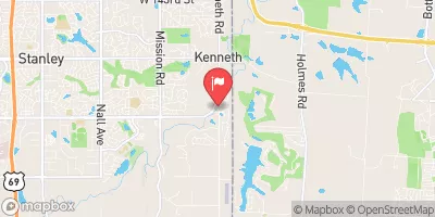
Hawthorne Valley Lake Dam, located in Kansas City, Kansas, is a privately owned structure designed for recreational purposes.
°F
°F
mph
Wind
%
Humidity
15-Day Weather Outlook
Summary
The dam, with a height of 15.5 feet and a length of 350 feet, holds a maximum storage capacity of 61.9 acre-feet and covers a surface area of 4.2 acres. Despite its fair condition assessment, the dam is classified as having a high hazard potential.
Situated along Tomahawk Creek, the Hawthorne Valley Lake Dam plays a crucial role in providing recreational opportunities for the local community. With a drainage area of 0.92 square miles, the dam serves as a popular spot for fishing, boating, and other outdoor activities. Although the dam has not been modified in recent years, regular inspections are conducted to ensure its structural integrity and safety.
As water resource and climate enthusiasts, it is important to recognize the significance of dams like Hawthorne Valley Lake Dam in balancing water management and recreational needs. By staying informed about the condition and maintenance of such structures, we can contribute to the sustainable use of water resources and the preservation of natural ecosystems in our community.
Dam Length |
350 |
Dam Height |
15.5 |
River Or Stream |
TOMAHAWK CREEK-TR |
Primary Dam Type |
Earth |
Surface Area |
4.2 |
Drainage Area |
0.92 |
Nid Storage |
61.9 |
Outlet Gates |
None |
Hazard Potential |
High |
Foundations |
Unlisted/Unknown |
Nid Height |
16 |
Seasonal Comparison
Hourly Weather Forecast
Nearby Streamflow Levels
Dam Data Reference
Condition Assessment
SatisfactoryNo existing or potential dam safety deficiencies are recognized. Acceptable performance is expected under all loading conditions (static, hydrologic, seismic) in accordance with the minimum applicable state or federal regulatory criteria or tolerable risk guidelines.
Fair
No existing dam safety deficiencies are recognized for normal operating conditions. Rare or extreme hydrologic and/or seismic events may result in a dam safety deficiency. Risk may be in the range to take further action. Note: Rare or extreme event is defined by the regulatory agency based on their minimum
Poor A dam safety deficiency is recognized for normal operating conditions which may realistically occur. Remedial action is necessary. POOR may also be used when uncertainties exist as to critical analysis parameters which identify a potential dam safety deficiency. Investigations and studies are necessary.
Unsatisfactory
A dam safety deficiency is recognized that requires immediate or emergency remedial action for problem resolution.
Not Rated
The dam has not been inspected, is not under state or federal jurisdiction, or has been inspected but, for whatever reason, has not been rated.
Not Available
Dams for which the condition assessment is restricted to approved government users.
Hazard Potential Classification
HighDams assigned the high hazard potential classification are those where failure or mis-operation will probably cause loss of human life.
Significant
Dams assigned the significant hazard potential classification are those dams where failure or mis-operation results in no probable loss of human life but can cause economic loss, environment damage, disruption of lifeline facilities, or impact other concerns. Significant hazard potential classification dams are often located in predominantly rural or agricultural areas but could be in areas with population and significant infrastructure.
Low
Dams assigned the low hazard potential classification are those where failure or mis-operation results in no probable loss of human life and low economic and/or environmental losses. Losses are principally limited to the owner's property.
Undetermined
Dams for which a downstream hazard potential has not been designated or is not provided.
Not Available
Dams for which the downstream hazard potential is restricted to approved government users.
Area Campgrounds
| Location | Reservations | Toilets |
|---|---|---|
 Longview Lake County Campground
|
||
 Scout Campsite #1
|
||
 Scout Campsite #2
|



 Hawthorne Valley Lake Dam
 Longview Reservoir At Kansas City
 River Trail Kansas City