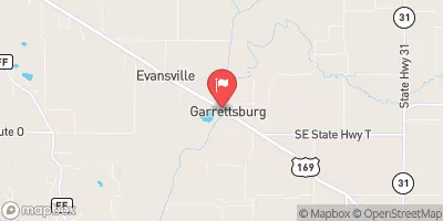
Site 12-7 Reservoir Report
Nearby: Dd No 12-12 Dd No 12-4
Last Updated: February 24, 2026
Site 12-7, located in Brown County, Kansas, is a rockfill dam completed in the year 2000 by the USDA NRCS.
Summary
This dam spans 625 feet in length and stands at a height of 38.6 feet, with a storage capacity of 109 acre-feet and a drainage area of 0.34 square miles. The dam serves the Wolf River-TR watershed and is regulated by the Kansas Department of Agriculture, with state permitting, inspection, and enforcement in place to ensure its safety and compliance with regulations.
Despite being classified as having a low hazard potential, Site 12-7 is considered to have a moderate risk level, with a moderate risk assessment rating of 3. The dam features an uncontrolled spillway with a width of 40 feet and has not been rated for condition assessment. The emergency action plan status and risk management measures for the dam are currently not available, indicating a potential area for improvement in terms of emergency preparedness and response.
In the realm of water resource and climate preservation, Site 12-7 plays a crucial role in managing water flow and storage in the region. With its strategic location and design, this dam contributes to the overall water management efforts in Brown County, emphasizing the importance of sustainable infrastructure for addressing the challenges posed by climate change and water resource management in the area.
°F
°F
mph
Wind
%
Humidity
15-Day Weather Outlook
Year Completed |
2000 |
Dam Length |
625 |
Dam Height |
38.6 |
River Or Stream |
WOLF RIVER-TR |
Primary Dam Type |
Rockfill |
Surface Area |
4.4 |
Drainage Area |
0.34 |
Nid Storage |
109 |
Outlet Gates |
None |
Hazard Potential |
Low |
Foundations |
Unlisted/Unknown |
Nid Height |
39 |
Seasonal Comparison
5-Day Hourly Forecast Detail
Nearby Streamflow Levels
 Delaware R Nr Muscotah
|
30cfs |
 Stranger C Nr Potter
|
199cfs |
 Missouri River At Rulo
|
23500cfs |
 Big Nemaha River At Falls City
|
99cfs |
 Missouri River At St. Joseph
|
24000cfs |
 Platte River Near Agency
|
91cfs |
Dam Data Reference
Condition Assessment
SatisfactoryNo existing or potential dam safety deficiencies are recognized. Acceptable performance is expected under all loading conditions (static, hydrologic, seismic) in accordance with the minimum applicable state or federal regulatory criteria or tolerable risk guidelines.
Fair
No existing dam safety deficiencies are recognized for normal operating conditions. Rare or extreme hydrologic and/or seismic events may result in a dam safety deficiency. Risk may be in the range to take further action. Note: Rare or extreme event is defined by the regulatory agency based on their minimum
Poor A dam safety deficiency is recognized for normal operating conditions which may realistically occur. Remedial action is necessary. POOR may also be used when uncertainties exist as to critical analysis parameters which identify a potential dam safety deficiency. Investigations and studies are necessary.
Unsatisfactory
A dam safety deficiency is recognized that requires immediate or emergency remedial action for problem resolution.
Not Rated
The dam has not been inspected, is not under state or federal jurisdiction, or has been inspected but, for whatever reason, has not been rated.
Not Available
Dams for which the condition assessment is restricted to approved government users.
Hazard Potential Classification
HighDams assigned the high hazard potential classification are those where failure or mis-operation will probably cause loss of human life.
Significant
Dams assigned the significant hazard potential classification are those dams where failure or mis-operation results in no probable loss of human life but can cause economic loss, environment damage, disruption of lifeline facilities, or impact other concerns. Significant hazard potential classification dams are often located in predominantly rural or agricultural areas but could be in areas with population and significant infrastructure.
Low
Dams assigned the low hazard potential classification are those where failure or mis-operation results in no probable loss of human life and low economic and/or environmental losses. Losses are principally limited to the owner's property.
Undetermined
Dams for which a downstream hazard potential has not been designated or is not provided.
Not Available
Dams for which the downstream hazard potential is restricted to approved government users.

 Site 12-7