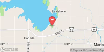
Dd No 118 Reservoir Report
Nearby: Dd No 119 Dd No 114 (Chandler)
Last Updated: February 21, 2026
Dd No 118, located in Chase County, Kansas, is a local government-owned dam designed by USDA SCS to reduce flood risk along Schaffer Creek-TR.
Summary
This Earth-type dam stands at a height of 35 feet and spans a length of 700 feet, with a storage capacity of 344.3 acre-feet. Despite being classified as having a low hazard potential, the dam's risk assessment is moderate (3), prompting the need for ongoing risk management measures.
The dam, constructed with a buttress core, is regulated and inspected by the Kansas Department of Agriculture, ensuring compliance with state permitting and enforcement requirements. The spillway, with a width of 40 feet, is uncontrolled, with a maximum discharge capacity of 1311 cubic feet per second. While the dam's condition assessment is currently not rated, the last inspection conducted in 1995 indicates that the structure has been in operation for several decades without major issues.
Water resource and climate enthusiasts interested in the management and maintenance of dams for flood risk reduction will find Dd No 118's data intriguing. With its location in a picturesque area near Strong City, Kansas, this dam serves as a vital infrastructure piece in protecting the surrounding community from potential flooding events. The dam's history, design specifications, and regulatory oversight provide valuable insights into the complexities of managing water resources in a changing climate.
°F
°F
mph
Wind
%
Humidity
15-Day Weather Outlook
Dam Length |
700 |
Dam Height |
35 |
River Or Stream |
SCHAFFER CREEK-TR |
Primary Dam Type |
Earth |
Surface Area |
6.8 |
Drainage Area |
1.27 |
Nid Storage |
344.3 |
Outlet Gates |
None |
Hazard Potential |
Low |
Foundations |
Unlisted/Unknown |
Nid Height |
35 |
Seasonal Comparison
5-Day Hourly Forecast Detail
Nearby Streamflow Levels
 Neosho R At Council Grove
|
1cfs |
 Cottonwood R Nr Plymouth
|
934cfs |
 Cottonwood R Nr Florence
|
251cfs |
 Cedar C Nr Cedar Point
|
64cfs |
 Neosho R Nr Americus
|
216cfs |
 N Cottonwood R Bl Marion Lk
|
409cfs |
Dam Data Reference
Condition Assessment
SatisfactoryNo existing or potential dam safety deficiencies are recognized. Acceptable performance is expected under all loading conditions (static, hydrologic, seismic) in accordance with the minimum applicable state or federal regulatory criteria or tolerable risk guidelines.
Fair
No existing dam safety deficiencies are recognized for normal operating conditions. Rare or extreme hydrologic and/or seismic events may result in a dam safety deficiency. Risk may be in the range to take further action. Note: Rare or extreme event is defined by the regulatory agency based on their minimum
Poor A dam safety deficiency is recognized for normal operating conditions which may realistically occur. Remedial action is necessary. POOR may also be used when uncertainties exist as to critical analysis parameters which identify a potential dam safety deficiency. Investigations and studies are necessary.
Unsatisfactory
A dam safety deficiency is recognized that requires immediate or emergency remedial action for problem resolution.
Not Rated
The dam has not been inspected, is not under state or federal jurisdiction, or has been inspected but, for whatever reason, has not been rated.
Not Available
Dams for which the condition assessment is restricted to approved government users.
Hazard Potential Classification
HighDams assigned the high hazard potential classification are those where failure or mis-operation will probably cause loss of human life.
Significant
Dams assigned the significant hazard potential classification are those dams where failure or mis-operation results in no probable loss of human life but can cause economic loss, environment damage, disruption of lifeline facilities, or impact other concerns. Significant hazard potential classification dams are often located in predominantly rural or agricultural areas but could be in areas with population and significant infrastructure.
Low
Dams assigned the low hazard potential classification are those where failure or mis-operation results in no probable loss of human life and low economic and/or environmental losses. Losses are principally limited to the owner's property.
Undetermined
Dams for which a downstream hazard potential has not been designated or is not provided.
Not Available
Dams for which the downstream hazard potential is restricted to approved government users.

 Dd No 118