North Pond Reservoir Report
Last Updated: February 22, 2026
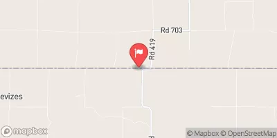
North Pond in Decatur, Kansas, is a privately owned earth dam structure located along the Rock Draw-TR stream.
Summary
Built with a height of 16 feet and a length of 2130 feet, the dam has a storage capacity of 66.5 acre-feet and serves the purpose of water resource management. Despite being unregulated by the state and having a low hazard potential, the dam has not been inspected since October 1998.
Although the dam's condition is currently listed as "Not Rated," its location in a rural area with limited drainage area presents a unique opportunity for water and climate enthusiasts to study the impact of small-scale water management structures on local ecosystems. With no associated structures or outlets, North Pond offers a natural setting for research and observation, highlighting the importance of maintaining and monitoring even low-hazard dams for long-term sustainability and resilience in the face of changing environmental conditions.
°F
°F
mph
Wind
%
Humidity
15-Day Weather Outlook
Dam Length |
2130 |
Dam Height |
16 |
River Or Stream |
ROCK DRAW-TR |
Primary Dam Type |
Earth |
Drainage Area |
0.13 |
Nid Storage |
66.5 |
Outlet Gates |
None |
Hazard Potential |
Low |
Foundations |
Unlisted/Unknown |
Nid Height |
16 |
Seasonal Comparison
5-Day Hourly Forecast Detail
Nearby Streamflow Levels
Dam Data Reference
Condition Assessment
SatisfactoryNo existing or potential dam safety deficiencies are recognized. Acceptable performance is expected under all loading conditions (static, hydrologic, seismic) in accordance with the minimum applicable state or federal regulatory criteria or tolerable risk guidelines.
Fair
No existing dam safety deficiencies are recognized for normal operating conditions. Rare or extreme hydrologic and/or seismic events may result in a dam safety deficiency. Risk may be in the range to take further action. Note: Rare or extreme event is defined by the regulatory agency based on their minimum
Poor A dam safety deficiency is recognized for normal operating conditions which may realistically occur. Remedial action is necessary. POOR may also be used when uncertainties exist as to critical analysis parameters which identify a potential dam safety deficiency. Investigations and studies are necessary.
Unsatisfactory
A dam safety deficiency is recognized that requires immediate or emergency remedial action for problem resolution.
Not Rated
The dam has not been inspected, is not under state or federal jurisdiction, or has been inspected but, for whatever reason, has not been rated.
Not Available
Dams for which the condition assessment is restricted to approved government users.
Hazard Potential Classification
HighDams assigned the high hazard potential classification are those where failure or mis-operation will probably cause loss of human life.
Significant
Dams assigned the significant hazard potential classification are those dams where failure or mis-operation results in no probable loss of human life but can cause economic loss, environment damage, disruption of lifeline facilities, or impact other concerns. Significant hazard potential classification dams are often located in predominantly rural or agricultural areas but could be in areas with population and significant infrastructure.
Low
Dams assigned the low hazard potential classification are those where failure or mis-operation results in no probable loss of human life and low economic and/or environmental losses. Losses are principally limited to the owner's property.
Undetermined
Dams for which a downstream hazard potential has not been designated or is not provided.
Not Available
Dams for which the downstream hazard potential is restricted to approved government users.


 North Pond