


Smithland Locks And Dam Reservoir Report
Last Updated: May 9, 2026
Nearby: Hohman Lake Dam Smithland Dam
°F
°F
mph
Wind
%
Humidity
Smithland Locks and Dam, located in Pope, Illinois along the Ohio River, was completed in 1980 by the US Army Corps of Engineers for navigation purposes.
Summary
This concrete dam stands at a height of 56 feet with a hydraulic height of 53 feet and a length of 130 feet. It serves multiple purposes including fish and wildlife pond, recreation, and water supply, with a normal storage capacity of 406,000 acre-feet. The dam features two locks, each 1,200 feet long and 110 feet wide, facilitating navigation along the river.
Despite its significant hazard potential, Smithland Locks and Dam is well-managed by the US Army Corps of Engineers to mitigate flood risks. The dam's emergency action plan is regularly updated, and risk management measures include continuous monitoring, prioritizing activities to reduce risks, and collaborating with local emergency managers to raise public awareness and develop evacuation plans. The Corps works diligently to ensure the dam's structural integrity and safety, crucial for water resource and climate enthusiasts interested in the dam's operations and risk management strategies.
Regional Streamflow Levels
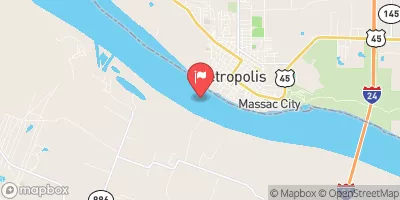 Ohio River At Metropolis
|
444000cfs |
 Massac Creek Near Paducah
|
2cfs |
 Little Bayou Creek Near Grahamville
|
1cfs |
 Bayou Creek Near Grahamville
|
5cfs |
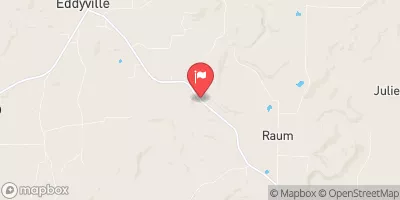 Lusk Creek Near Eddyville
|
30cfs |
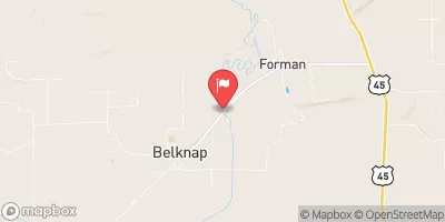 Cache River At Forman
|
44cfs |
15-Day Long Term Forecast
Year Completed |
1980 |
Dam Length |
130 |
River Or Stream |
OHIO RIVER |
Primary Dam Type |
Concrete |
Surface Area |
23600 |
Length Of Locks |
1200 |
Hydraulic Height |
53 |
Drainage Area |
144000 |
Nid Storage |
738700 |
Structural Height |
56 |
Outlet Gates |
Tainter (radial) - 11 |
Hazard Potential |
Significant |
Nid Height |
56 |
Seasonal Comparison
5-Day Hourly Forecast Detail
Dam Data Reference
Condition Assessment
SatisfactoryNo existing or potential dam safety deficiencies are recognized. Acceptable performance is expected under all loading conditions (static, hydrologic, seismic) in accordance with the minimum applicable state or federal regulatory criteria or tolerable risk guidelines.
Fair
No existing dam safety deficiencies are recognized for normal operating conditions. Rare or extreme hydrologic and/or seismic events may result in a dam safety deficiency. Risk may be in the range to take further action. Note: Rare or extreme event is defined by the regulatory agency based on their minimum
Poor A dam safety deficiency is recognized for normal operating conditions which may realistically occur. Remedial action is necessary. POOR may also be used when uncertainties exist as to critical analysis parameters which identify a potential dam safety deficiency. Investigations and studies are necessary.
Unsatisfactory
A dam safety deficiency is recognized that requires immediate or emergency remedial action for problem resolution.
Not Rated
The dam has not been inspected, is not under state or federal jurisdiction, or has been inspected but, for whatever reason, has not been rated.
Not Available
Dams for which the condition assessment is restricted to approved government users.
Hazard Potential Classification
HighDams assigned the high hazard potential classification are those where failure or mis-operation will probably cause loss of human life.
Significant
Dams assigned the significant hazard potential classification are those dams where failure or mis-operation results in no probable loss of human life but can cause economic loss, environment damage, disruption of lifeline facilities, or impact other concerns. Significant hazard potential classification dams are often located in predominantly rural or agricultural areas but could be in areas with population and significant infrastructure.
Low
Dams assigned the low hazard potential classification are those where failure or mis-operation results in no probable loss of human life and low economic and/or environmental losses. Losses are principally limited to the owner's property.
Undetermined
Dams for which a downstream hazard potential has not been designated or is not provided.
Not Available
Dams for which the downstream hazard potential is restricted to approved government users.
Area Campgrounds
 Pearcy Camp
 Nickell Branch Basic Campground - Land Between the Lakes
 Cedar Grove Camping Area
 Demumbers Bay Backcountry Area & Boat Ramp at Land Between The Lakes
 Birmangham Ferry Backcountry Area & Boat Ramp at Land Between The Lakes
 Tower Rock Campsite
Nearby Reservoirs
 Smithland Dam Road Pope County
River Runs
-
 Bridge At Eddyville Blacktop To Confluence With Ohio River At Golconda,Il
-
 1 Minle Southwest Of Delwood, Il (Sec. 18, T11S, R13E) To Reesville, 1/4 Mile South Of The Confluence With Sugar Creek
-
 Source, About 2 Miles East Of Delwood, Il (Sec 10, T11S, R6E) To Bridge At Eddyville Blacktop (Se1/4,Sec.16,T12S, R6E)
-
 Russell Cemetery, Approx 1/4 Mile North Of Karbers Ridge Road To Proclamation Boundary, 1 Mile Nw Of Elizabethtown,Il
-
 Wallace Cemetery Approx 2.5 Miles Nw Of Herod, Il To Confluence With Ohio River At Golconda Jobs Corp Center
 Lake Tecumseh
 One Horse Gap Lake
 Little Cache Lake #1 (Bowman Lake)
 Dutchman Lake
 Lake of Egypt