Dewey Dam Reservoir Report
Last Updated: February 2, 2026
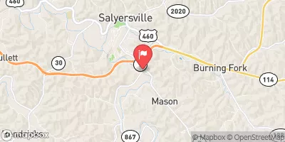
Dewey Dam, also known as Dewey Lake, is a federal-owned structure located in Floyd County, Kentucky.
°F
°F
mph
Wind
%
Humidity
15-Day Weather Outlook
Summary
Completed in 1949 by the US Army Corps of Engineers, this Earth-type dam serves multiple purposes including flood risk reduction, fish and wildlife habitat, and recreation. With a structural height of 118 feet and a hydraulic height of 86 feet, Dewey Dam helps to manage water levels on Johns Creek of Levisa Fork.
The dam has a storage capacity of 93,300 acre-feet and covers a surface area of 1,100 acres. Despite its high hazard potential, the USACE implements risk management measures, such as regular inspections, emergency action plans, and maintenance activities, to mitigate potential flood risks associated with the dam. By collaborating with local emergency managers and the public, the USACE ensures the safety and integrity of Dewey Dam for the surrounding community.
As a vital infrastructure for flood control and ecosystem preservation, Dewey Dam stands as a testament to the USACE's commitment to managing water resources effectively and safeguarding communities from potential risks. With ongoing monitoring and maintenance efforts, Dewey Dam continues to play a crucial role in water resource management in the region, demonstrating the importance of sustainable infrastructure development in the face of changing climate conditions.
Year Completed |
1949 |
Dam Length |
913 |
River Or Stream |
JOHNS CREEK OF LEVISA FORK |
Primary Dam Type |
Earth |
Surface Area |
1100 |
Hydraulic Height |
86 |
Drainage Area |
206 |
Nid Storage |
93300 |
Structural Height |
118 |
Outlet Gates |
Slide (sluice gate) - 3 |
Hazard Potential |
High |
Foundations |
Soil |
Nid Height |
118 |
Seasonal Comparison
Hourly Weather Forecast
Nearby Streamflow Levels
 Levisa Fork At Paintsville
|
919cfs |
 Licking River Below Mason Fork Nr Salyersville
|
67cfs |
 Tug Fork At Kermit
|
870cfs |
 Johns Creek Near Meta
|
24cfs |
 Levisa Fork At Pikeville
|
729cfs |
 Tug Fork At Williamson
|
474cfs |
Dam Data Reference
Condition Assessment
SatisfactoryNo existing or potential dam safety deficiencies are recognized. Acceptable performance is expected under all loading conditions (static, hydrologic, seismic) in accordance with the minimum applicable state or federal regulatory criteria or tolerable risk guidelines.
Fair
No existing dam safety deficiencies are recognized for normal operating conditions. Rare or extreme hydrologic and/or seismic events may result in a dam safety deficiency. Risk may be in the range to take further action. Note: Rare or extreme event is defined by the regulatory agency based on their minimum
Poor A dam safety deficiency is recognized for normal operating conditions which may realistically occur. Remedial action is necessary. POOR may also be used when uncertainties exist as to critical analysis parameters which identify a potential dam safety deficiency. Investigations and studies are necessary.
Unsatisfactory
A dam safety deficiency is recognized that requires immediate or emergency remedial action for problem resolution.
Not Rated
The dam has not been inspected, is not under state or federal jurisdiction, or has been inspected but, for whatever reason, has not been rated.
Not Available
Dams for which the condition assessment is restricted to approved government users.
Hazard Potential Classification
HighDams assigned the high hazard potential classification are those where failure or mis-operation will probably cause loss of human life.
Significant
Dams assigned the significant hazard potential classification are those dams where failure or mis-operation results in no probable loss of human life but can cause economic loss, environment damage, disruption of lifeline facilities, or impact other concerns. Significant hazard potential classification dams are often located in predominantly rural or agricultural areas but could be in areas with population and significant infrastructure.
Low
Dams assigned the low hazard potential classification are those where failure or mis-operation results in no probable loss of human life and low economic and/or environmental losses. Losses are principally limited to the owner's property.
Undetermined
Dams for which a downstream hazard potential has not been designated or is not provided.
Not Available
Dams for which the downstream hazard potential is restricted to approved government users.
Area Campgrounds
| Location | Reservations | Toilets |
|---|---|---|
 Jenny Wiley State Park
|
||
 German Bridge - Dewey Lake
|
||
 Paintsville Lake State Park
|

 Dewey Dam