


Whitetail C Reservoir Report
Last Updated: April 26, 2026
°F
°F
mph
Wind
%
Humidity
Whitetail C is a private earth dam located in Montgomery Township, Franklin, Pennsylvania, along the TR Licking Creek.
Summary
The dam, with a height of 23 feet and a length of 419 feet, serves primarily for recreation purposes. It is regulated by the Pennsylvania Department of Environmental Protection, ensuring that it meets state inspection and enforcement standards. The dam has a significant hazard potential and is currently assessed to be in fair condition.
Despite its fair condition, Whitetail C poses a potential risk due to its significant hazard potential. While the dam has not undergone recent modifications or inspections, it is still subject to regular monitoring and assessment. The dam's emergency action plan status is currently unknown, raising concerns about its preparedness in case of a significant event. With its location along the TR Licking Creek, the dam plays a crucial role in managing water resources and climate impacts in the area.
Water resource and climate enthusiasts should keep an eye on Whitetail C to ensure that it remains in compliance with state regulations and safety standards. As a key structure for recreation purposes, the dam's maintenance and monitoring are essential to prevent any potential risks to the surrounding community and environment. With its fair condition and significant hazard potential, ongoing assessment and management measures are crucial to ensure the safety and sustainability of Whitetail C for the future.
Regional Streamflow Levels
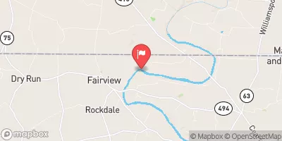 Conococheague Creek At Fairview
|
273cfs |
 Potomac River At Hancock
|
1190cfs |
 Tonoloway Creek Near Needmore
|
5cfs |
 Back Creek Near Jones Springs
|
35cfs |
 Marsh Run At Grimes
|
9cfs |
 Antietam Creek Near Waynesboro
|
87cfs |
15-Day Long Term Forecast
Dam Length |
419 |
Dam Height |
23 |
River Or Stream |
TR LICKING CREEK |
Primary Dam Type |
Earth |
Drainage Area |
0.28 |
Hazard Potential |
Significant |
Foundations |
Unlisted/Unknown |
Nid Height |
23 |
Seasonal Comparison
5-Day Hourly Forecast Detail
Dam Data Reference
Condition Assessment
SatisfactoryNo existing or potential dam safety deficiencies are recognized. Acceptable performance is expected under all loading conditions (static, hydrologic, seismic) in accordance with the minimum applicable state or federal regulatory criteria or tolerable risk guidelines.
Fair
No existing dam safety deficiencies are recognized for normal operating conditions. Rare or extreme hydrologic and/or seismic events may result in a dam safety deficiency. Risk may be in the range to take further action. Note: Rare or extreme event is defined by the regulatory agency based on their minimum
Poor A dam safety deficiency is recognized for normal operating conditions which may realistically occur. Remedial action is necessary. POOR may also be used when uncertainties exist as to critical analysis parameters which identify a potential dam safety deficiency. Investigations and studies are necessary.
Unsatisfactory
A dam safety deficiency is recognized that requires immediate or emergency remedial action for problem resolution.
Not Rated
The dam has not been inspected, is not under state or federal jurisdiction, or has been inspected but, for whatever reason, has not been rated.
Not Available
Dams for which the condition assessment is restricted to approved government users.
Hazard Potential Classification
HighDams assigned the high hazard potential classification are those where failure or mis-operation will probably cause loss of human life.
Significant
Dams assigned the significant hazard potential classification are those dams where failure or mis-operation results in no probable loss of human life but can cause economic loss, environment damage, disruption of lifeline facilities, or impact other concerns. Significant hazard potential classification dams are often located in predominantly rural or agricultural areas but could be in areas with population and significant infrastructure.
Low
Dams assigned the low hazard potential classification are those where failure or mis-operation results in no probable loss of human life and low economic and/or environmental losses. Losses are principally limited to the owner's property.
Undetermined
Dams for which a downstream hazard potential has not been designated or is not provided.
Not Available
Dams for which the downstream hazard potential is restricted to approved government users.
 Cove Valley Christian Youth Camp
 Licking Creek Campsite
 Licking Creek Hiker Biker Campsite
 North Mountain Campsite
 North Mountain Hiker Biker Campsite
 McCoys Ferry Campground