


Hidden Spring Dam Reservoir Report
Last Updated: April 25, 2026
°F
°F
mph
Wind
%
Humidity
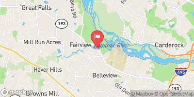
Hidden Spring Dam, located in Fairfax, Virginia, is a privately owned earth dam with a primary purpose of recreation.
Summary
Standing at a height of 20 feet and stretching 370 feet in length, the dam creates a storage capacity of 55.65 acre-feet and covers a surface area of 4.99 acres. It is situated on Mine Run, a tributary, and is regulated by the Department of Conservation and Recreation in Virginia.
Despite its recreational focus, the dam's hazard potential is marked as "Undetermined" and its condition assessment is listed as "Not Rated." The dam has not been inspected recently, with the last reported inspection date unknown. It is unknown if an Emergency Action Plan (EAP) has been prepared or if it meets guidelines, indicating a potential area for improvement in emergency preparedness and risk management for the structure.
For water resource and climate enthusiasts, Hidden Spring Dam presents an intriguing case study in private ownership and regulation for recreational purposes. The dam's location in Fairfax, Virginia, and its connection to Mine Run highlight the importance of managing water resources effectively while ensuring public safety. With its unique characteristics and regulatory oversight, Hidden Spring Dam offers an opportunity for further exploration and analysis in the realm of dam management and climate resilience.
Regional Streamflow Levels


15-Day Long Term Forecast
Dam Length |
370 |
Dam Height |
20 |
River Or Stream |
Mine Run, tributary |
Primary Dam Type |
Earth |
Surface Area |
4.99 |
Hydraulic Height |
20 |
Nid Storage |
55.65 |
Structural Height |
20 |
Hazard Potential |
Undetermined |
Nid Height |
20 |
Seasonal Comparison
5-Day Hourly Forecast Detail
Dam Data Reference
Condition Assessment
SatisfactoryNo existing or potential dam safety deficiencies are recognized. Acceptable performance is expected under all loading conditions (static, hydrologic, seismic) in accordance with the minimum applicable state or federal regulatory criteria or tolerable risk guidelines.
Fair
No existing dam safety deficiencies are recognized for normal operating conditions. Rare or extreme hydrologic and/or seismic events may result in a dam safety deficiency. Risk may be in the range to take further action. Note: Rare or extreme event is defined by the regulatory agency based on their minimum
Poor A dam safety deficiency is recognized for normal operating conditions which may realistically occur. Remedial action is necessary. POOR may also be used when uncertainties exist as to critical analysis parameters which identify a potential dam safety deficiency. Investigations and studies are necessary.
Unsatisfactory
A dam safety deficiency is recognized that requires immediate or emergency remedial action for problem resolution.
Not Rated
The dam has not been inspected, is not under state or federal jurisdiction, or has been inspected but, for whatever reason, has not been rated.
Not Available
Dams for which the condition assessment is restricted to approved government users.
Hazard Potential Classification
HighDams assigned the high hazard potential classification are those where failure or mis-operation will probably cause loss of human life.
Significant
Dams assigned the significant hazard potential classification are those dams where failure or mis-operation results in no probable loss of human life but can cause economic loss, environment damage, disruption of lifeline facilities, or impact other concerns. Significant hazard potential classification dams are often located in predominantly rural or agricultural areas but could be in areas with population and significant infrastructure.
Low
Dams assigned the low hazard potential classification are those where failure or mis-operation results in no probable loss of human life and low economic and/or environmental losses. Losses are principally limited to the owner's property.
Undetermined
Dams for which a downstream hazard potential has not been designated or is not provided.
Not Available
Dams for which the downstream hazard potential is restricted to approved government users.
Area Campgrounds
| Location | Reservations | Toilets |
|---|---|---|
 Swains Lock Hiker-Biker Campsite
|
||
 Marsden Tract Group Campsite
|
||
 Marsden Tract Campground
|
||
 Lake Fairfax
|
||
 Horsepen Branch
|
||
 Horsepen Branch Campsite
|
 Dalecarlia Reservoir
 Gillam Branch (historical)
 Davis Branch (historical)
 Maddox Branch
 Georgetown Reservoir