Squaw Creek dam

Squaw Creek
Squaw Creek, located in Marinette, Wisconsin, is a privately owned dam with a primary purpose of recreation. Completed in 1961, this gravity dam stands at a height of 11 feet and has a storage capacity of 52 acre-feet, with a normal storage level of 30 acre-feet. The dam is situated on Squaw Creek, with a drainage area of 10 square miles and a maximum discharge capacity of 375 cubic feet per second.
Despite being classified as having a low hazard potential, Squaw Creek dam has a moderate risk assessment rating of 3. The condition assessment of the dam is currently marked as "Not Rated," with the last inspection date recorded in November 2012. The dam's inspection frequency is every 10 years, and it is regulated, permitted, inspected, and enforced by the Wisconsin Department of Natural Resources (WIDNR). The dam does not have an Emergency Action Plan (EAP) in place, indicating potential room for improvement in emergency preparedness.
Overall, Squaw Creek serves as a vital recreational resource in the area, offering opportunities for outdoor activities and water-based recreation. While the dam has a relatively low hazard potential, there is a moderate risk associated with its current condition. Continued monitoring and maintenance efforts, along with the development of an EAP, could help ensure the safety and longevity of Squaw Creek dam for both recreational users and the surrounding community.
Plan around the weather
Same NOAA / yr.no feed Snoflo's iOS app uses. Watch the precipitation column on the meteogram -- rain on the basin upstream typically lifts inflow 24-72 hours later.
Next 5 days, hour by hour
Temperature line with weather symbols on top, snow + rain accumulation as columns, humidity as a dotted line.
5-day forecast table
Every 3 hours, broken out across temperature, snow, rain, humidity, and wind. Each cell is colour-coded relative to the column min/max.
| Time | Condition | Temp (°F) | Snow (in) | Rain (in) | Humidity (%) | Wind (mps) | Wind dir |
|---|---|---|---|---|---|---|---|
| Loading detailed forecast… | |||||||
15-day temperature & precipitation
Daily temperatures, snow, and rain projected over the next two weeks.
Nearby streamflow gauges
USGS streamgauges around Squaw Creek -- inflows here typically show up in storage 24-72 hours later.
| Streamgauge | Discharge | View |
|---|---|---|
| Menominee River At White Rapids Dam Near Banat | 2,190 cfs | → |
| Pike River At Amberg | 135 cfs | → |
| Menominee River At Koss | 2,340 cfs | → |
| Menominee River Below Pemene Creek Near Pembine | 1,770 cfs | → |
| Menominee River Near Mc Allister | 2,440 cfs | → |
| Menominee River Near Vulcan | 1,880 cfs | → |
Make a day of it
Boat launches, lakeside camping, fishing access, and other reservoirs near Squaw Creek.
Boat launches
See all →


Campgrounds
See all →


Fishing spots
See all →


River runs
See all →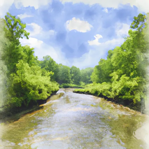


About Squaw Creek
Where does the data for Squaw Creek come from?
Structural and regulatory data come from the U.S. Army Corps of Engineers' National Inventory of Dams (NID). Weather forecast comes from NOAA / yr.no -- the same feed Snoflo's iOS app uses.
How often is the report updated?
NID structural data refreshes annually as the Corps publishes updated assessments. The weather forecast refreshes throughout the day.
What does the Low hazard rating mean?
The Corps of Engineers' hazard potential classification grades probable consequences if the dam fails: High = probable loss of human life; Significant = no probable loss of human life but possible economic loss / environmental damage; Low = no probable loss of human life, only minor economic / environmental losses. See the Dam Data Reference card below for the full definitions.
What's "% of normal"?
The current storage value compared to the historical average storage on this calendar day. 100% = right on average; values above 100% mean above-normal storage (wet year); values below mean below-normal (dry year or drought).
Can I get alerts when storage crosses a threshold?
Yes -- alerts are managed in the Snoflo iOS app. Favorite this dam, set a threshold, and you'll get a push the moment conditions cross.
Dam data reference
Condition Assessment
- Satisfactory
- No existing or potential dam safety deficiencies are recognized. Acceptable performance is expected under all loading conditions (static, hydrologic, seismic) in accordance with the minimum applicable state or federal regulatory criteria or tolerable risk guidelines.
- Fair
- No existing dam safety deficiencies are recognized for normal operating conditions. Rare or extreme hydrologic and/or seismic events may result in a dam safety deficiency. Risk may be in the range to take further action.
- Poor
- A dam safety deficiency is recognized for normal operating conditions which may realistically occur. Remedial action is necessary. POOR may also be used when uncertainties exist as to critical analysis parameters which identify a potential dam safety deficiency.
- Unsatisfactory
- A dam safety deficiency is recognized that requires immediate or emergency remedial action for problem resolution.
- Not Rated
- The dam has not been inspected, is not under state or federal jurisdiction, or has been inspected but, for whatever reason, has not been rated.
Hazard Potential Classification
- High
- Dams assigned the high hazard potential classification are those where failure or mis-operation will probably cause loss of human life.
- Significant
- Dams assigned the significant hazard potential classification are those dams where failure or mis-operation results in no probable loss of human life but can cause economic loss, environmental damage, disruption of lifeline facilities, or impact other concerns. Significant hazard potential classification dams are often located in predominantly rural or agricultural areas but could be in areas with population and significant infrastructure.
- Low
- Dams assigned the low hazard potential classification are those where failure or mis-operation results in no probable loss of human life and low economic and/or environmental losses. Losses are principally limited to the owner's property.
- Undetermined
- Dams for which a downstream hazard potential has not been designated or is not provided.