Old Veterans State Camp Ground Campground
Community Reviews
Been here? Share the conditions.
Reviews, ratings & photos are added in the free Snoflo iOS app — rate a spot, tag the conditions, and your visit is verified by location. Add or manage your reviews from the app.
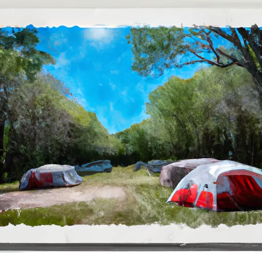
Old Veterans State Camp Ground
Reservations are accepted at Old Veterans State Campground, allowing campers to secure their spot in advance. It is advisable to make reservations, especially during peak seasons, to guarantee availability. The campground is open year-round, making it suitable for camping enthusiasts throughout the year.
The best time to visit Old Veterans State Campground is during the summer months when the weather is pleasant for outdoor activities. However, it is important to note that mosquitos can be a nuisance during this time, so insect repellent is recommended. Furthermore, the campground is known for its picturesque views, especially during the fall season when the leaves change color. It is advised to bring warm clothing during the cooler months.
In conclusion, Old Veterans State Campground in Wisconsin is a fantastic camping destination offering various amenities and accepting reservations. Whether visiting during the summer for ideal weather or in the fall for stunning scenery, campers can enjoy a comfortable stay with access to facilities such as restrooms, showers, picnic areas, and playgrounds.
What's on-site at Old Veterans State Camp Ground
Key facilities Snoflo tracks for this campground. Confirm with the operator before booking -- amenities can change seasonally.
Plan your trip down to the hour
Same weather feed Snoflo's iOS app uses -- updated continuously from NOAA / yr.no.
Next 5 days, hour by hour
Temperature line with weather symbols on top, snow + rain accumulation as columns, humidity as a dotted line.
5-day forecast table
Every 3 hours, broken out across temperature, snow, rain, humidity, and wind. Each cell is colour-coded relative to the column min/max so trends jump out at a glance.
| Time | Condition | Temp (°F) | Snow (in) | Rain (in) | Humidity (%) | Wind (mps) | Wind dir |
|---|---|---|---|---|---|---|---|
| Loading detailed forecast… | |||||||
15-day temperature & precipitation
Daily temperatures, snow, and rain projected over the next two weeks. Hover any point for the full breakdown.
Other campgrounds in the area
Snoflo-tracked campsites within driving distance of Old Veterans State Camp Ground, with reservations status.
| Campground | Reservations | Toilets | View |
|---|---|---|---|
| Old Veterans Lake County Park | ✗ | ✗ | → |
| Governor Thompson State Park Campground | ✗ | ✗ | → |
| Twin Bridge County Park | ✗ | ✗ | → |
| Veterans Memorial Park - Crivitz | ✗ | ✓ | → |
| Silver Cliff Camp | ✗ | ✗ | → |
Nearby streamflow
USGS streamgauges within reach of Old Veterans State Camp Ground -- pulled live from the National Water Information System.
| Streamgauge | Discharge | View |
|---|---|---|
| Peshtigo River Near Wabeno | 195 cfs | → |
| Pike River At Amberg | 111 cfs | → |
| Menominee River At White Rapids Dam Near Banat | 1,640 cfs | → |
| Peshtigo River At Porterfield | 356 cfs | → |
| Menominee River At Koss | 1,980 cfs | → |
| Menominee River Below Pemene Creek Near Pembine | 1,390 cfs | → |
Nearby snow depths
NRCS SNOTEL stations within reach of Old Veterans State Camp Ground -- relevant when planning a shoulder-season or alpine trip.
| SNOTEL station | Snowpack | 24h Snowfall | View |
|---|---|---|---|
| Crivitz High Falls | 8.0 in | 0.0 in | → |
| Athelstane | 0.0 in | 0.0 in | → |
| Amberg 9 E | 0.0 in | 0.0 in | → |
| Suring | 0.0 in | 0.0 in | → |
| Aurora | 0.0 in | 0.0 in | → |
| Stiles 1s | 8.0 in | 5.9 in | → |
Plan a longer trip
The closest parks, lakes, boat launches, and paddle runs so a camping night can grow into a full weekend.
Parks
- Old Veteran Lake Park
- Twin Bridge Park
- Mcclintock County Park
- Amberg Wildlife Area
- Daves Falls Park
- Town Corner Wildlife Area
Boat launches
- High Falls Reservoir -- Landing No. 6 - Peshtigo Riv Sf
- High Falls Reservoir -- Landing No. 7 Peshtigo Riv Sf
- Caldron Falls Reservoir -- Caldron Bay - #8
- Caldron Falls Reservoir -- South Bay - #13
- Caldron Falls Reservoir -- Muskie Point - #9
- High Falls Reservoir -- Channel - #5
Fishing spots
Paddle runs
- Sec 12/13 Line, T35n, R16e To Forest Boundary In Sec 24, T35n, R16e
- Confluence With Armstrong Creek To Sec 12/13 Line, T35n, R16e
- 1/4 Mile Upstream From Evans Bridge To Confluence With Armstrong Creek
- 1/4 Mile Downstream From Ccc Bridge To 1/4 Mile Upstream From Evans Bridge
- Railroad Bridge To 1/4 Mile Downstream From The Ccc Bridge
- Main Branch-Forest Boundary In Sec 18, T37n, R15e To Railroad Bridge
Camping essentials & Leave No Trace
- Pack it in, pack it out
- Take all trash, food scraps, and gear back with you to keep campsites clean and protect wildlife.
- Respect wildlife
- Observe animals from a distance, store food securely, and never feed wildlife to maintain natural behavior and safety.
- Know before you go
- Check weather, fire restrictions, trail conditions, and permit requirements to ensure a safe and well-planned trip.
- Minimize campfire impact
- Use established fire rings, keep fires small, fully extinguish them, or opt for a camp stove when fires are restricted.
- Leave what you find
- Preserve natural and cultural features by avoiding removal of plants, rocks, artifacts, or other elements of the environment.
Set push alerts in the Snoflo app
Save Old Veterans State Camp Ground as a favorite, set a custom threshold (precipitation, snowpack, freezing temperatures), and the iOS app will push the moment conditions cross.
About Old Veterans State Camp Ground
Can I make reservations at Old Veterans State Camp Ground?
This campground does not appear to accept reservations -- it's typically first-come, first-served. Arrive early on summer weekends.
How fresh is the weather data on this page?
The hourly forecast updates throughout the day from the NOAA / yr.no public feeds. Streamflow data is pulled live from USGS streamgauges and snowpack from the NRCS SNOTEL network.
What's the best time of year to visit?
Use the 15-day temperature & precipitation outlook on this page to plan -- pick a window with comfortable temperatures and low precipitation. For longer trips, the 5-day hourly meteogram shows snow + rain accumulation hour-by-hour.
How do I get to Old Veterans State Camp Ground?
Tap Directions in the hero above to open driving directions in Google Maps, or Open in map to center the Snoflo interactive map on the campground.
Can I get alerts when conditions change?
Yes -- alerts are managed through the Snoflo iOS app. Favorite this campground, set a threshold (temperature, snowpack, precipitation), and you'll get a push the moment it crosses.
Other campgrounds near here
Snoflo-tracked campgrounds within driving distance of Old Veterans State Camp Ground.