
Bear Creek Watershed Site 51 Reservoir Report
Last Updated: December 14, 2025
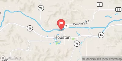
Bear Creek Watershed Site 51, located in Quandahl, Iowa, is a key site for flood risk reduction along the TR-South Bear Creek.
°F
°F
mph
Wind
%
Humidity
Summary
Constructed in 2005 by the USDA NRCS, this earth dam stands at a height of 30 feet and spans 240 feet in length, with a storage capacity of 25 acre-feet. The primary purpose of this dam is flood risk reduction, serving not only to protect the local community but also to manage water resources effectively in the area. With a low hazard potential and a moderate risk assessment rating, this site plays a crucial role in mitigating potential flood damage and ensuring the safety of the surrounding area.
Despite not being state regulated, Bear Creek Watershed Site 51 is a significant asset in the region, with its stone core and soil foundation contributing to its structural integrity. The dam's uncontrolled spillway, with a width of 10 feet, further enhances its ability to manage water flow during heavy rainfall events. While the dam's condition is currently not rated, its location in a high-risk area underscores the importance of ongoing monitoring and maintenance to ensure its continued effectiveness in flood risk reduction efforts. This site serves as a testament to the collaborative efforts of local government and federal agencies in safeguarding water resources and enhancing climate resilience in the Bear Creek Watershed.
Year Completed |
2005 |
Dam Length |
240 |
Dam Height |
30 |
River Or Stream |
TR-South Bear Creek |
Primary Dam Type |
Earth |
Surface Area |
1 |
Drainage Area |
0.21 |
Nid Storage |
25 |
Hazard Potential |
Low |
Foundations |
Soil |
Nid Height |
30 |
Seasonal Comparison
Weather Forecast
Nearby Streamflow Levels
 Upper Iowa River Near Dorchester
|
885cfs |
 Upper Iowa River At Decorah
|
257cfs |
 Upper Iowa River At Bluffton
|
421cfs |
 South Fork Root River Near Houston
|
353cfs |
 Turkey River At Spillville
|
28cfs |
 Root River Near Houston
|
1260cfs |
Dam Data Reference
Condition Assessment
SatisfactoryNo existing or potential dam safety deficiencies are recognized. Acceptable performance is expected under all loading conditions (static, hydrologic, seismic) in accordance with the minimum applicable state or federal regulatory criteria or tolerable risk guidelines.
Fair
No existing dam safety deficiencies are recognized for normal operating conditions. Rare or extreme hydrologic and/or seismic events may result in a dam safety deficiency. Risk may be in the range to take further action. Note: Rare or extreme event is defined by the regulatory agency based on their minimum
Poor A dam safety deficiency is recognized for normal operating conditions which may realistically occur. Remedial action is necessary. POOR may also be used when uncertainties exist as to critical analysis parameters which identify a potential dam safety deficiency. Investigations and studies are necessary.
Unsatisfactory
A dam safety deficiency is recognized that requires immediate or emergency remedial action for problem resolution.
Not Rated
The dam has not been inspected, is not under state or federal jurisdiction, or has been inspected but, for whatever reason, has not been rated.
Not Available
Dams for which the condition assessment is restricted to approved government users.
Hazard Potential Classification
HighDams assigned the high hazard potential classification are those where failure or mis-operation will probably cause loss of human life.
Significant
Dams assigned the significant hazard potential classification are those dams where failure or mis-operation results in no probable loss of human life but can cause economic loss, environment damage, disruption of lifeline facilities, or impact other concerns. Significant hazard potential classification dams are often located in predominantly rural or agricultural areas but could be in areas with population and significant infrastructure.
Low
Dams assigned the low hazard potential classification are those where failure or mis-operation results in no probable loss of human life and low economic and/or environmental losses. Losses are principally limited to the owner's property.
Undetermined
Dams for which a downstream hazard potential has not been designated or is not provided.
Not Available
Dams for which the downstream hazard potential is restricted to approved government users.
 Bear Creek Watershed Site 51
 The "Lower" Dam, Near The Confluence Of Coon Creek To Lane'S Bridge